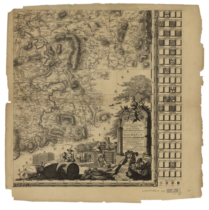
This new map of the county of Hereford, Sheet 2. engrav'd from the original drawing made from an accurate survey proved by trigonometry
- Title
- This new map of the county of Hereford, Sheet 2. engrav'd from the original drawing made from an accurate survey proved by trigonometry
Alternative Title: New map of the county of Hereford, Sheet 2 - Creator / Contributor
- Taylor, Isaac, 1750-1807
- Place of Origin
- England
Ross - Publisher
- Isaac Taylor
- Date
- 1754
- Language
- English
- Description
- Extent: 1 map on 4 sheets ; 114 x 92 cm, sheets 66 x 66 cm
- Subjects
- Genre
- map
cartographic image
Early works
Maps
Early works to 1800 - Notes
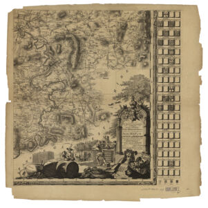
- Relief shown by hachures.
Cartouche illustrates the agriculture of the county ; cider presses, wool etc.
Dedication in cartouche : To my worthy subscribers in general, but more particularly to the noble gentlemen & c who honoured me with their assistance.
Includes text, inset of Hereford, and illus. of the coats of arms of subscribers.
Also available online.
Attribution: is most humbly dedicated by their obedient humble servt., Isaac Taylor ; T. Kitchin sculpt. - Series
- Harvard Map Collection digital maps. England. Herefordshire
Harvard Map Collection digital maps. England. Hereford - Repository
- Harvard Map Collection, Harvard University
