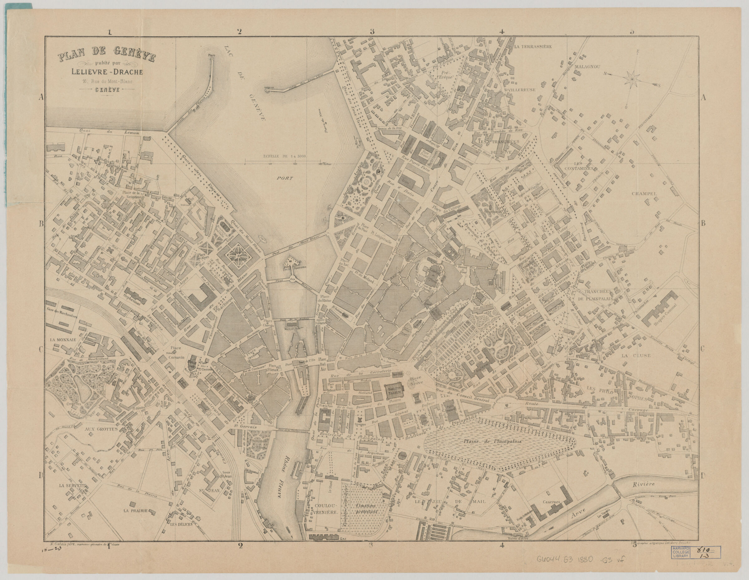
Plan de Genève
- Title
- Plan de Genève
- Creator / Contributor
- Galais, N.
- Place of Origin
- Switzerland
Genève - Publisher
- publié par Lelièvre-Drache
- Date
- 1880
- Language
- French
- Description
- Extent: 1 map ; 45 x 58 cm. + accompanying index (16 p. ; 19cm.)
- Subjects
- Scale 1:3,000.
Geneva (Switzerland)--Maps - Genre
- map
Maps - Notes
- Shows names of streets, buildings, parks, drainage, and other points of interest.
North oriented to the left.
Accompanying index issued in blue pamphlet cover with title: Plan de la ville de Genève.
Also available online.
Electronic reproduction. Cambridge, Mass. : Harvard Geospatial Library, 2014. Georeferenced image for use in a GIS.
Attribution: N. Galais père, ingéniuer géomètre de [1ere] classe; litographie artistique Lelièvre-Drache. - Series
- Harvard Map Collection digital maps. Imaging the Urban Environment
Harvard Map Collection digital maps. Switzerland. Geneva - Repository
- Harvard Map Collection, Harvard University
Tools & Related Links
- This item appears in
- Scanned Maps
- City Maps and Urban Environments
- More item details
- HOLLIS Record
