-
Title
-
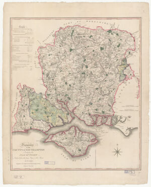
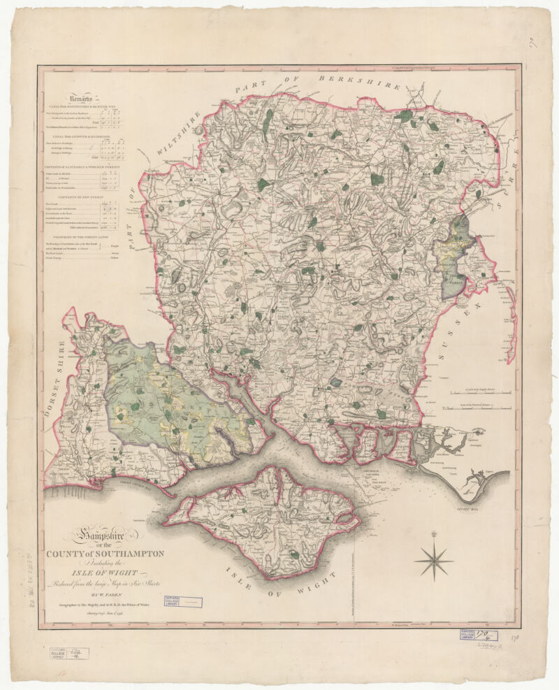
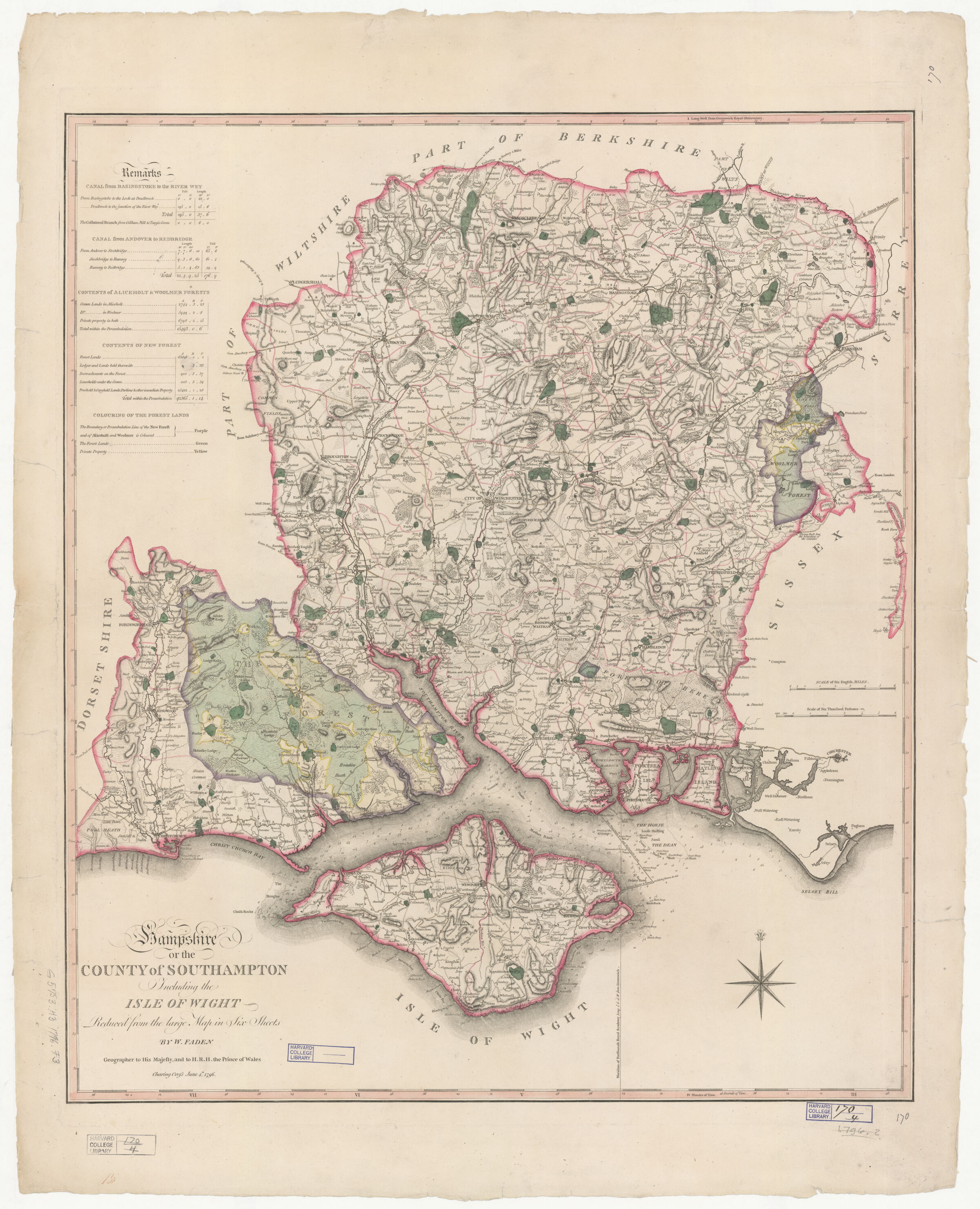
Hampshire or The county of Southampton including the Isle of Wight ; County of Southampton including the Isle of Wight
-
- Faden, William, 1749-1836, creator
-
- reduced from the large map in six sheets by W. Faden, Geographer to His Majesty, and to H.R.H. the Prince of Wales.
-
- June 4th, 1796
1796
-
- England
[London
-
- W. Faden ... Charing Cross
-
- 1 map : hand col. ; 65 x 56 cm.
-
- English
-
- map
Road maps.
Early maps.
Maps
Early works to 1800
-
- Images
-
- Isle of Wight (England)--Maps--Early works to 1800
Hampshire (England)--Maps--Early works to 1800
-
- England--London
England--Hampshire
-
- Relief shown by hachures, depth shown by soundings.
Also available online.
-
- Harvard Map Collection digital maps
-
- Harvard Map Collection, Harvard University
-
- 990133746100203941
-
Title
-
Hampshire or The county of Southampton including the Isle of Wight ; County of Southampton including the Isle of Wight
-
Creator / Contributor
- Faden, William, 1749-1836, creator
-
Attribution
- reduced from the large map in six sheets by W. Faden, Geographer to His Majesty, and to H.R.H. the Prince of Wales.
-
Date
- June 4th, 1796
1796
-
Place of Origin
- England
[London
-
Publisher
- W. Faden ... Charing Cross
-
Extent
- 1 map : hand col. ; 65 x 56 cm.
-
Language
- English
-
Genre
- map
Road maps.
Early maps.
Maps
Early works to 1800
-
Digital Format
- Images
-
Subjects
- Isle of Wight (England)--Maps--Early works to 1800
Hampshire (England)--Maps--Early works to 1800
-
Places
- England--London
England--Hampshire
-
Notes
- Relief shown by hachures, depth shown by soundings.
Also available online.
-
Series
- Harvard Map Collection digital maps
-
Repository
- Harvard Map Collection, Harvard University
-
Record ID
- 990133746100203941