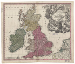
Magna Britannia ; Grosser atlas uber die gantze Welt. Map no. 18 ; complectens Angliae, Scotiae et Hiberniae regna in suas provincias et comitatus divisa repraesente
Relief shown pictorially. Prime meridian: Ferro. Watermark: right centre. Decorative title cartouche (uncoloured) with portrait of Queen Anne, with 2 lines of Ovid above portrait, possibly referring to Treaty of Utrecht, 1713, and note in Latin about Act of Union, 1707. Boundaries (national, regional and county); cities, towns, etc.; 5 bar scales. Appears in: Grosser atlas uber die gantze welt... Nürnberg : J.B. Homann, 1716. (Map no. 18) Also available online.
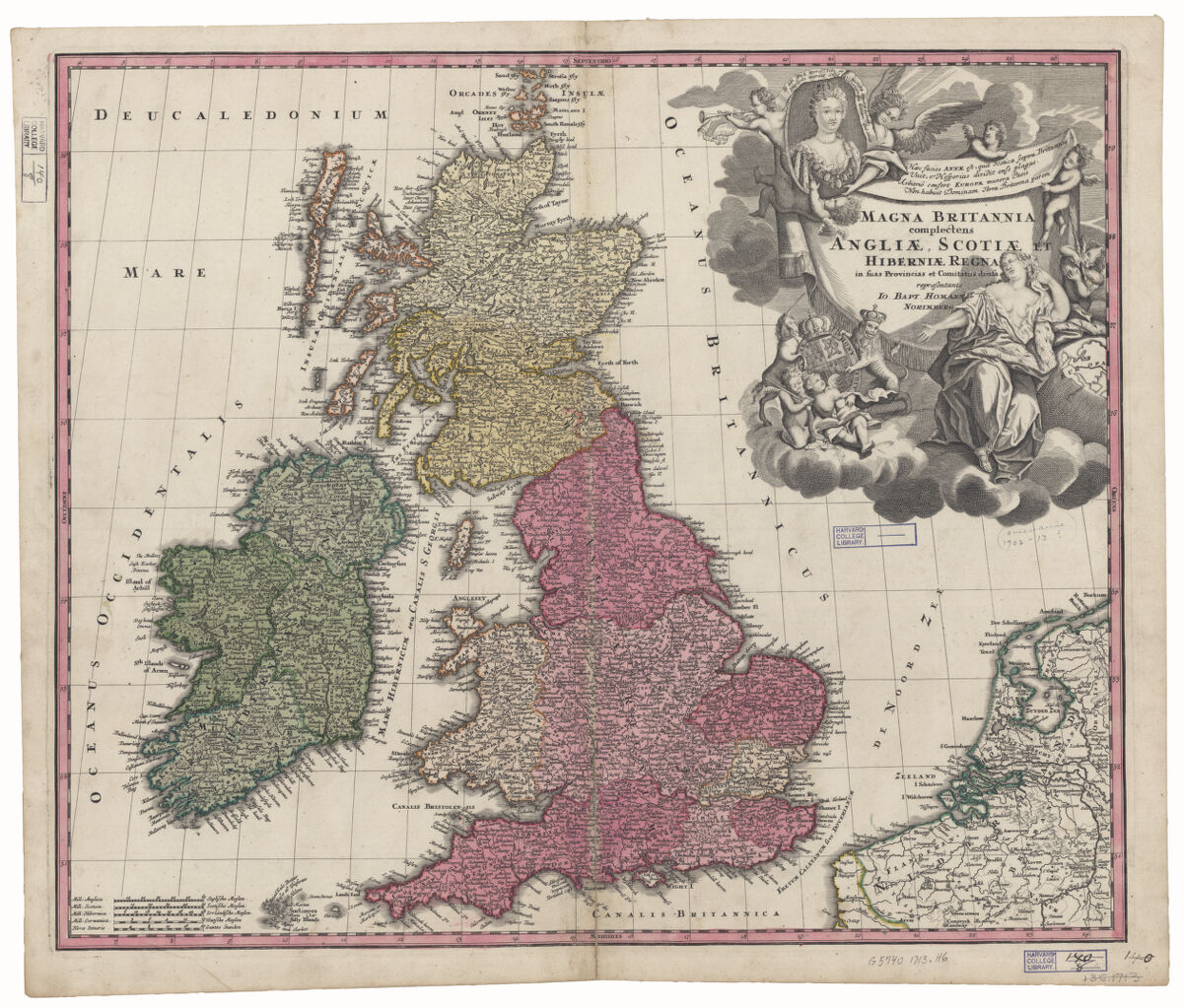