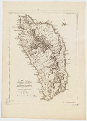
Title
La Dominique située entre La Martinique et La Guadeloupe ; conquise par M. le Mis. de Bouillé Marechal des camps et armées du Roi, le 7 Septembre 1778
Creator / Contributor
Le Rouge, Georges-Louis, creator
Attribution
levée en 1773 traduite de l'Anglais.
Date
[1779] 1779
Place of Origin
France Paris
Publisher
par le Rouge, Ingenieur Géographe du Roi
Extent
1 map ; 61 x 47 cm.
Language
French
Genre
map Early maps Maps Early works to 1800
Digital Format
Images
Subjects
Bouillé, François-Claude-Amour Dominica--History--Revolution, 1775-1783--Maps--Early works to 1800 West Indies--History--Revolution, 1775-1783--Maps--Early works to 1800 United States--History--Revolution, 1775-1783--Maps--Early works to 1800 Dominica--Maps--Early works to 1800
Notes
Shows names of rivers, ports, and other points of interest.
Series
Harvard Map Collection digital maps
Repository
Harvard Map Collection, Harvard University
Record ID
990106859260203941
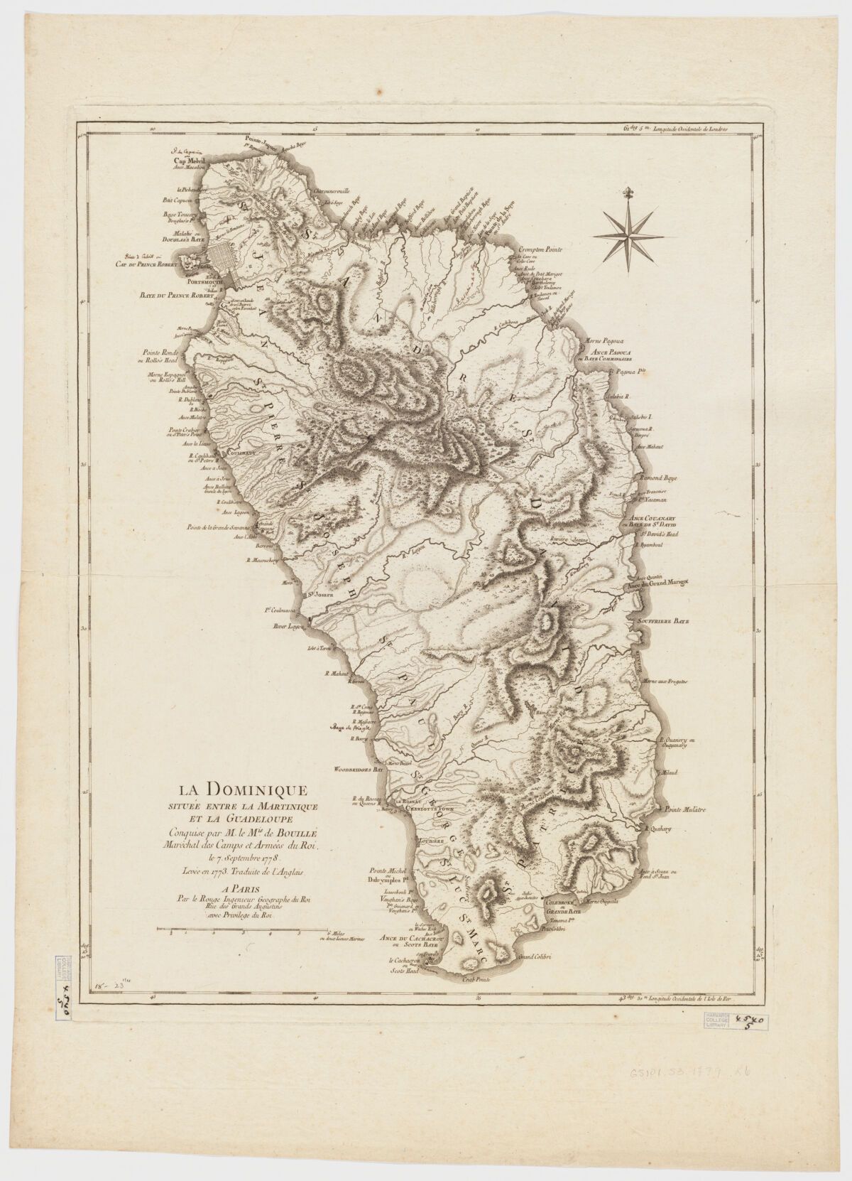