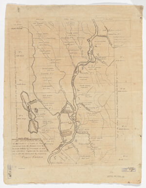
An accurate plan of 189,120 acres of land on Penobscot River being the purchase from the Penobscot Indians by government on each side said river together with two gores of land, one on each side
Shows township divisions with areas in acres. Available also as a digital image through the Harvard University Web site. Electronic reproduction. Cambridge, Mass. : Harvard Geospatial Library, 2007 Georeferenced image for use in a GIS.