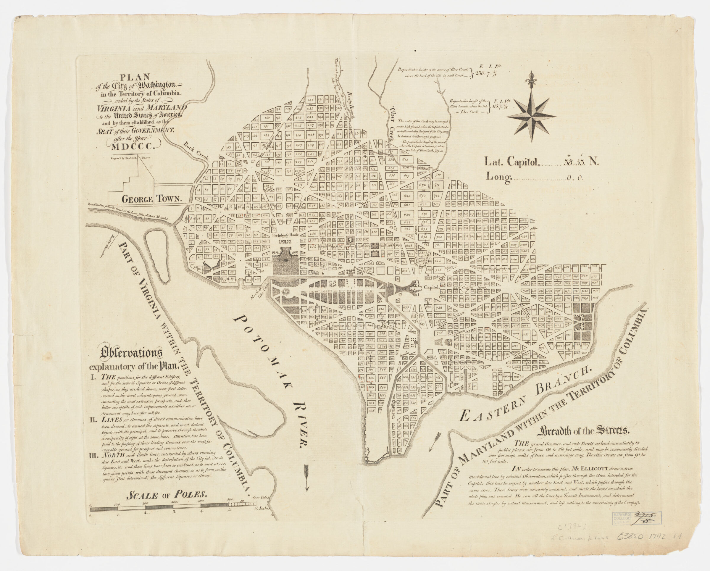
Plan of the city of Washington in the territory of Columbia ; ceded by the states of Virginia and Maryland to the United States of America, and by them established as the seat of their government, after the year MDCCC
Ellicott, Andrew, 1754-1820, creator Hill, Samuel, approximately 1766-1804
engrav'd by Sam'l Hill, Boston ; in order to execute this plan, Mr. Ellicott drew a true meridional line ...
Shows block numbers and proposed government buildings. Includes text and notes. Available also as a digital image through the Harvard University Web site. Electronic reproduction. Cambridge, Mass. : Harvard Geospatial Library, 2008 Georeferenced image for use in a GIS.
Plan of the city of Washington in the territory of Columbia ; ceded by the states of Virginia and Maryland to the United States of America, and by them established as the seat of their government, after the year MDCCC
Creator / Contributor
Ellicott, Andrew, 1754-1820, creator Hill, Samuel, approximately 1766-1804
Attribution
engrav'd by Sam'l Hill, Boston ; in order to execute this plan, Mr. Ellicott drew a true meridional line ...
Shows block numbers and proposed government buildings. Includes text and notes. Available also as a digital image through the Harvard University Web site. Electronic reproduction. Cambridge, Mass. : Harvard Geospatial Library, 2008 Georeferenced image for use in a GIS.