- Title
- [Bonin Islands, Japan]
- United States, Hydrographic Office., creator
Knorr, E. R. (Ernest Rudolph)
Beechey, Frederick William, 1796-1856
Wyman, R. H. (Robert Harris), 1822-1882
Waldecker, Louis. - projected by E.R. Knorr ; reduction for engraving by Louis Waldecker.
- 1886
- District of Columbia
[Washington, D.C.] - Hydrographic Office, U.S. Navy
- Ed. of June 1886.
- 4 maps on 1 sheet ; 41 x 61 cm., each map 41 x 34 cm. or smaller.
- English
- map
Maps - Images
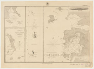
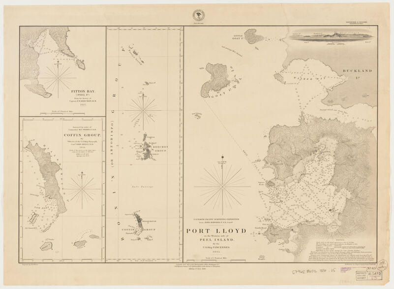
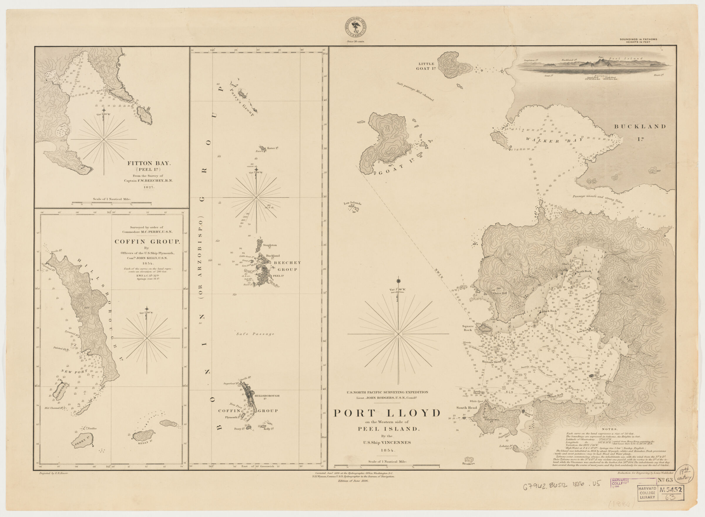
- Fitton Bay (Peel Ild) / from the survey of Captain F.W. Beechey, R.N. 1827 -- Coffin Group / by officers of the U.S. Ship Plymouth Camdr. John Kelly, U.S.N. 1854 -- Bonin (or Arzobispo) Group -- Port Lloyd: on the western side of Peel Island (includes inset view and notes)/ by the U.S. Ship Vincennes 1854.
- Vincennes (Cruiser)
Nautical charts--Japan--Bonin Islands
Bonin Islands (Japan)--Discovery and exploration--Maps
Haha Island (Japan)--Discovery and exploration--Maps - Title supplied by cataloger.
Relief shown by contours and spot heights. Depths shown by soundings.
Below lower margin: "Corrected Jany. 1873 at the Hydrographic Office, Washington, D.C. R.H. Wyman, Commo. U.S.N. Hydrographer to the Bureau of Navigation ..."
"No. 63." - Open Collections Program at Harvard University
- Harvard Map Collection, Harvard University
- 990115400960203941
- Title
- [Bonin Islands, Japan]
- Creator / Contributor
- United States, Hydrographic Office., creator
Knorr, E. R. (Ernest Rudolph)
Beechey, Frederick William, 1796-1856
Wyman, R. H. (Robert Harris), 1822-1882
Waldecker, Louis. - Attribution
- projected by E.R. Knorr ; reduction for engraving by Louis Waldecker.
- Date
- 1886
- Place of Origin
- District of Columbia
[Washington, D.C.] - Publisher
- Hydrographic Office, U.S. Navy
- Edition
- Ed. of June 1886.
- Extent
- 4 maps on 1 sheet ; 41 x 61 cm., each map 41 x 34 cm. or smaller.
- Language
- English
- Genre
- map
Maps - Digital Format
- Images
- Contents
- Fitton Bay (Peel Ild) / from the survey of Captain F.W. Beechey, R.N. 1827 -- Coffin Group / by officers of the U.S. Ship Plymouth Camdr. John Kelly, U.S.N. 1854 -- Bonin (or Arzobispo) Group -- Port Lloyd: on the western side of Peel Island (includes inset view and notes)/ by the U.S. Ship Vincennes 1854.
- Subjects
- Vincennes (Cruiser)
Nautical charts--Japan--Bonin Islands
Bonin Islands (Japan)--Discovery and exploration--Maps
Haha Island (Japan)--Discovery and exploration--Maps - Notes
- Title supplied by cataloger.
Relief shown by contours and spot heights. Depths shown by soundings.
Below lower margin: "Corrected Jany. 1873 at the Hydrographic Office, Washington, D.C. R.H. Wyman, Commo. U.S.N. Hydrographer to the Bureau of Navigation ..."
"No. 63." - Series
- Open Collections Program at Harvard University
- Repository
- Harvard Map Collection, Harvard University
- Record ID
- 990115400960203941
Tools & Related Links
- More item details
- HOLLIS Record
Contacts
-
Joseph deVeerLibrary Project Manager and Museum LiaisonErnst Mayr Library617-495-3946
-