- Title
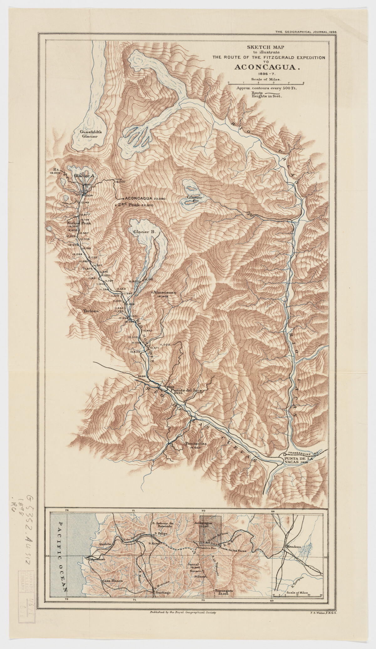
- Sketch map to illustrate the route of the Fitzgerald expedition to Aconcagua
- [1898]
1898 - England
London - Royal Geographical Society
- 1 map : col. ; 50 x 26 cm.
- English
- map
Maps - Images
- Fitz Gerald, E. A. (Edward Arthur)--Travel--Maps
Aconagua (Argentina)--Discovery and exploration--Maps
Aconcagua, Mount (Argentina)--Discovery and exploration--Maps - Relief shown by contours, shading and spot heights.
In upper right margin: The Geographical Journal, 1898. - Open Collections Program at Harvard University
- Harvard Map Collection, Harvard University
- 990108197510203941
- Title
- Sketch map to illustrate the route of the Fitzgerald expedition to Aconcagua
- Date
- [1898]
1898 - Place of Origin
- England
London - Publisher
- Royal Geographical Society
- Extent
- 1 map : col. ; 50 x 26 cm.
- Language
- English
- Genre
- map
Maps - Digital Format
- Images
- Subjects
- Fitz Gerald, E. A. (Edward Arthur)--Travel--Maps
Aconagua (Argentina)--Discovery and exploration--Maps
Aconcagua, Mount (Argentina)--Discovery and exploration--Maps - Notes
- Relief shown by contours, shading and spot heights.
In upper right margin: The Geographical Journal, 1898. - Series
- Open Collections Program at Harvard University
- Repository
- Harvard Map Collection, Harvard University
- Record ID
- 990108197510203941
Tools & Related Links
- More item details
- HOLLIS Record
Contacts
-
Joseph deVeerLibrary Project Manager and Museum LiaisonErnst Mayr Library617-495-3946
-