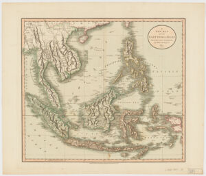
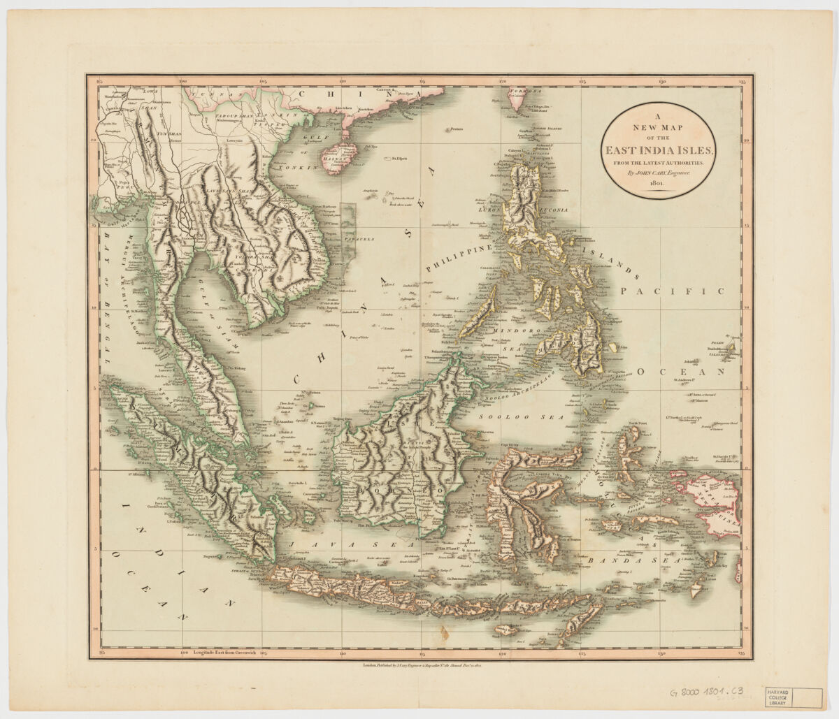
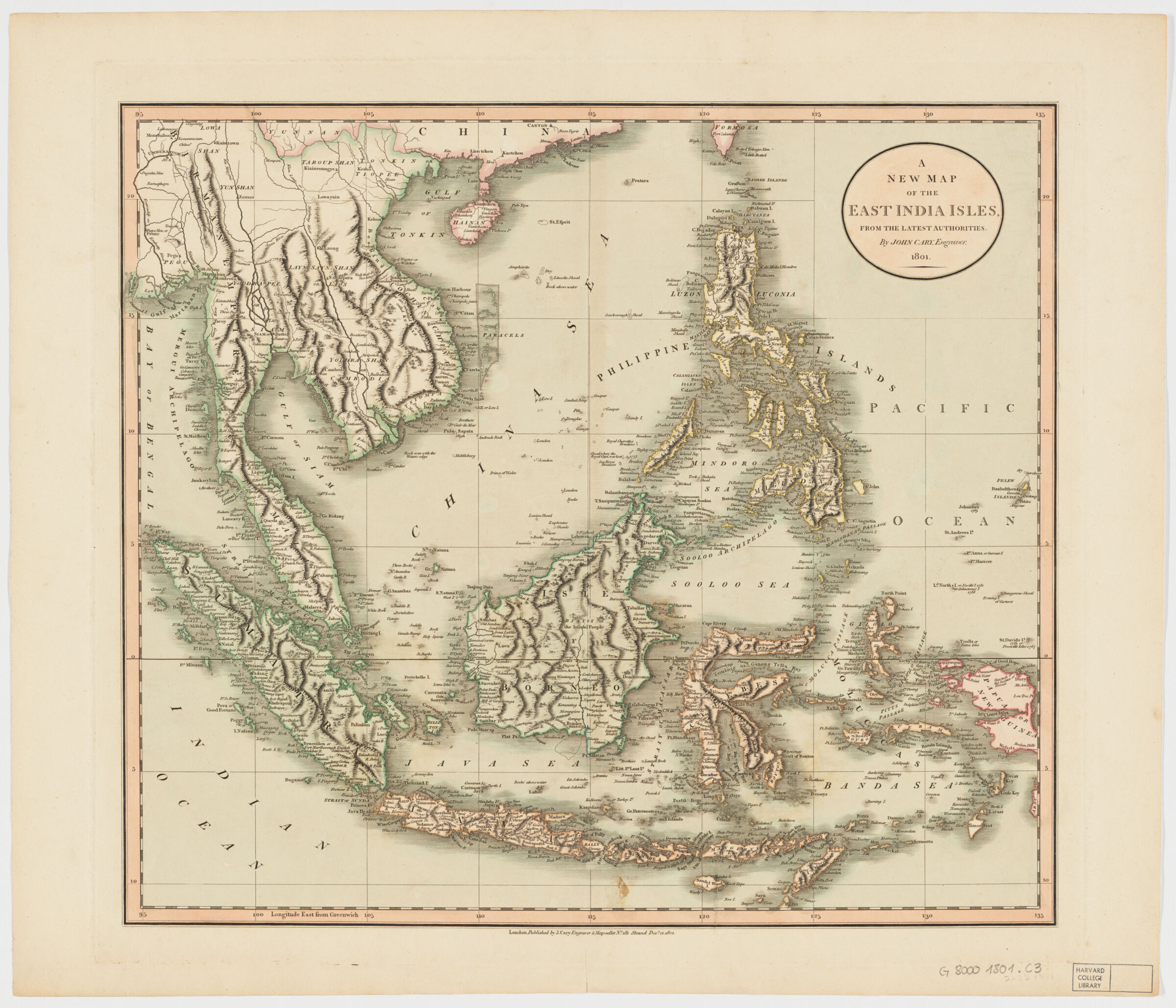
Cary's new universal atlas A new map of the East India Isles. from the latest authorities
- Title
- Cary's new universal atlas A new map of the East India Isles. from the latest authorities
- Creator / Contributor
- Cary, John, approximately 1754-1835
- Place of Origin
- England
London - Publisher
- J. Cary
1808 - Date
- Dec. 21, 1801
- Language
- English
- Description
- Extent: 1 map : hand col. ; 44 x 50 cm.
- Subjects
- Places
- England--London
- Genre
- map
government publication
Maps - Notes
- Relief shown pictorially and with shading.
Prime meridian: Greenwich.
Covers Sumatra, Java, Borneo, Sulawesi, the Philippines, Papua new Guinea and portions of China, Burma and Malaysia.
Shows boundaries, rivers, roads and settlements.
Electronic reproduction. Cambridge, Mass. : Harvard Geospatial Library, 2009. Georeferenced image for use in a GIS.
Attribution: by John Cary. - Series
- Open Collections Program at Harvard University. Islamic Heritage Project
- Repository
- Harvard Map Collection, Harvard University
