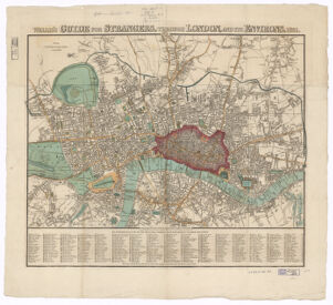
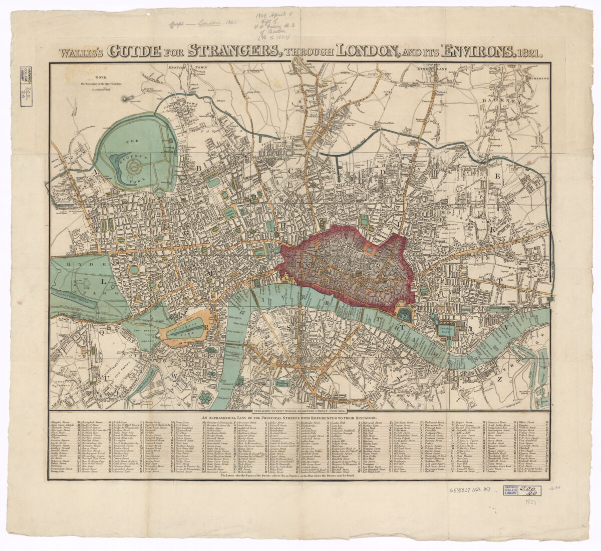
First published in 1820; latest ed. with date in title altered to 1845. Date taken from A catalogue of maps, plans and views of London, Westminster and Southwark collected and arranged by Frederick Crace, 1878. Map is divided into rectangles and lettered for reference. Regents Canal and Southwark Bridge shown. River, docks, some roads and green spaces coloured; City of London outlined and coloured in red. Available also online.
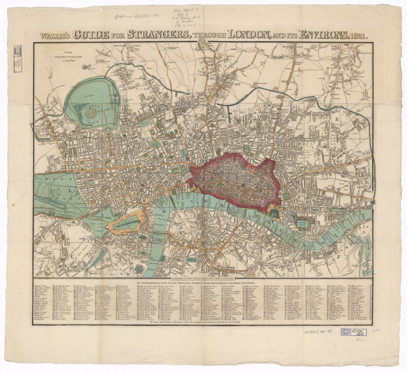
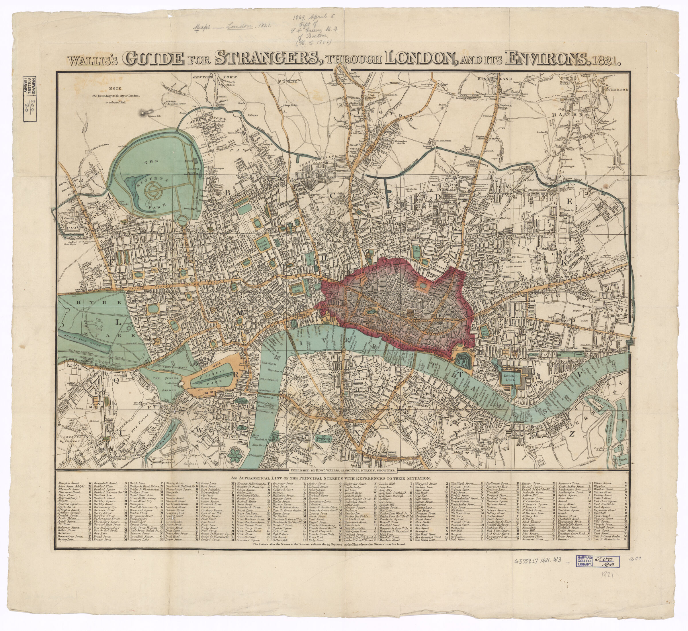
First published in 1820; latest ed. with date in title altered to 1845. Date taken from A catalogue of maps, plans and views of London, Westminster and Southwark collected and arranged by Frederick Crace, 1878. Map is divided into rectangles and lettered for reference. Regents Canal and Southwark Bridge shown. River, docks, some roads and green spaces coloured; City of London outlined and coloured in red. Available also online.