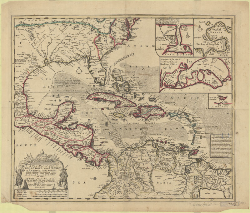
A new map of the West-Indies; or the Islands of America in the North Sea ; with the adjacent parts, explaining what belongs to England, Holland, Spain, France &c. Also the several tracts made by the gallions and flota
Visscher, Nicolaes, 1618-1679, creator Overton, Henry, 1675 or 1676-1751
Relief shown pictorially, depths indicated by soundings. "Is now done into English with many considerable improvements according to the newest and best Observations". Includes 4 insets: A draught of y.e bay & citty of Havanna; The bay of Porto Bella. A draught of y.e citty of Cartagena its harbour & forts; la Vera Cruz. Includes also an advertisement dated Jany. 1740 for 'Geography Epitomis'd. Also available online.
A new map of the West-Indies; or the Islands of America in the North Sea ; with the adjacent parts, explaining what belongs to England, Holland, Spain, France &c. Also the several tracts made by the gallions and flota
Creator / Contributor
Visscher, Nicolaes, 1618-1679, creator Overton, Henry, 1675 or 1676-1751
Relief shown pictorially, depths indicated by soundings. "Is now done into English with many considerable improvements according to the newest and best Observations". Includes 4 insets: A draught of y.e bay & citty of Havanna; The bay of Porto Bella. A draught of y.e citty of Cartagena its harbour & forts; la Vera Cruz. Includes also an advertisement dated Jany. 1740 for 'Geography Epitomis'd. Also available online.