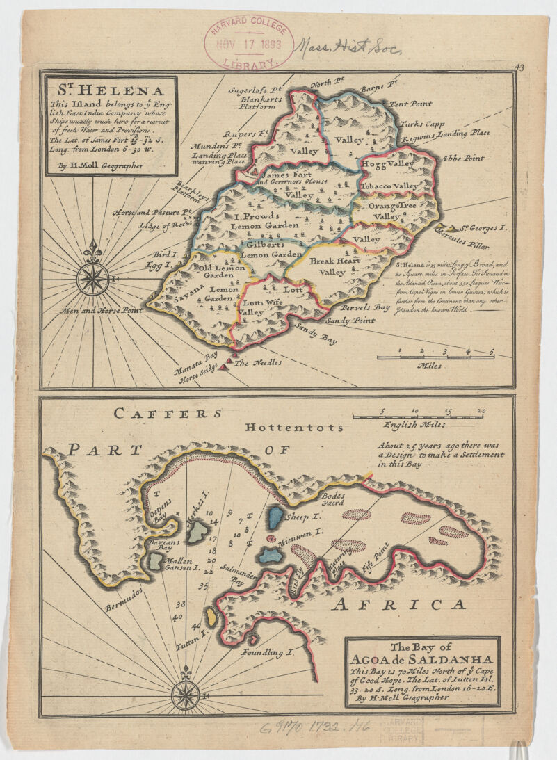
St. Helena ; Saint Helena ; Bay of Agoa de Saldanha, this bay is 70 miles north of ye Cape of Good Hope ; this island belongs to ye English East India Company whose ships usually touch here for a recruit of fresh water and provisions ... ; The bay of Agoa de Saldanha, this bay is 70 miles north of ye Cape of Good Hope ; this island belongs to ye English East India Company whose ships usually touch here for a recruit of fresh water and provisions
Imprint derived from the atlas in which the map was issued. Numbered 43. Relief shown pictorially ; depth shown by soundings (given in fathoms). Prime meridian London. From: Moll, Herman Atlas Minor ... / Herman Moll. London: Thomas Bowles and John Bowles, 1732? Also available online. Island of St. Helena ; Saldanha Bay, South Africa.