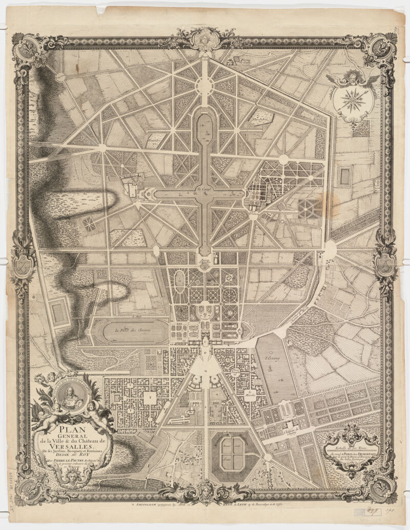
Title
Plan général de la ville et du château de Versailles ; de ses jardins, bosquets et fontaines dedié au Roy
Creator / Contributor
Lepautre, Pierre, 1660-1744, creator
Attribution
par Pierre le Pautre, architecte et graveur ordinaire de sa Majesté ; Eleazar Gouman fecit.
Date
[1725] 1725
Place of Origin
Netherlands Amsterdam
Publisher
uytgegeven by And. en Hand. de Leth. op de Beurszluys in de Visser
Extent
1 map ; 78 x 63 cm.
Language
French
Genre
map Engraving, Dutch-France-Versailles-Maps-18th century. Early maps Maps Early works to 1800
Digital Format
Images
Subjects
Gardens--France--Maps--Early works to 1800 Gardens--France--Versailles--Maps--Early works to 1800 Versailles (France)--Maps--Early works to 1800 Parc de Versailles (Versailles, France)--Maps--Early works to 1800 Paris Region (France)--Maps--Early works to 1800
Notes
Relief shown by hachures.
Series
Harvard Map Collection digital maps
Repository
Harvard Map Collection, Harvard University
Record ID
990109116300203941
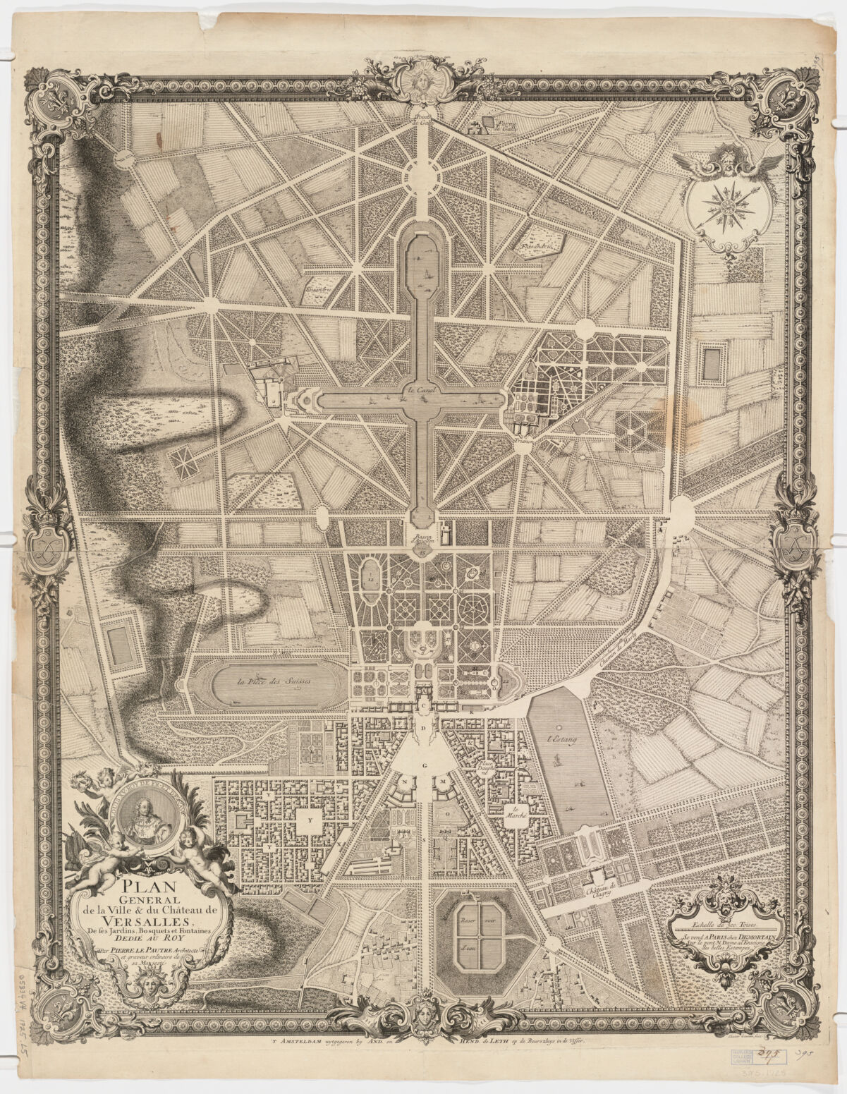