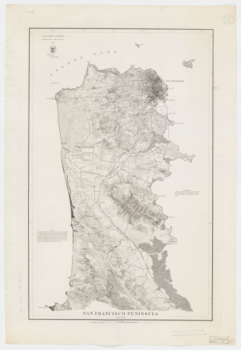
Relief shown by contours and spot heights. Shows drainage, railroads, etc. "Note: This map is reduced from surveys made ... between 1850 and '57 ... and from supplementary surveys of the interior made ... in 1867 and '68 ... The scale of the original maps is 1:10,000." Contour interval 20 ft. Available also as a digital image through the Harvard University Web site. Electronic reproduction. Cambridge, Mass. : Harvard Geospatial Library, 2008 Georeferenced image for use in a GIS.
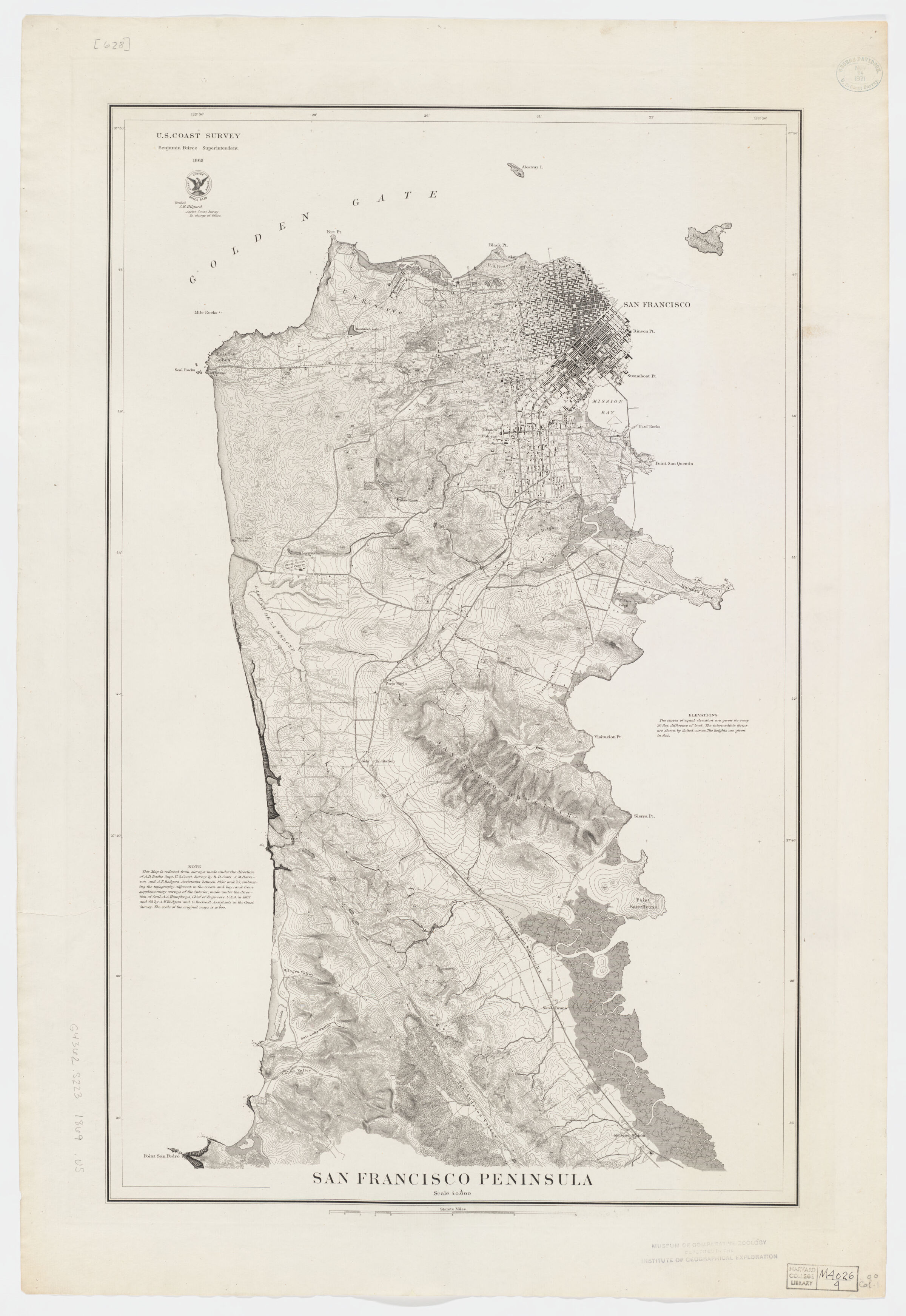
Relief shown by contours and spot heights. Shows drainage, railroads, etc. "Note: This map is reduced from surveys made ... between 1850 and '57 ... and from supplementary surveys of the interior made ... in 1867 and '68 ... The scale of the original maps is 1:10,000." Contour interval 20 ft. Available also as a digital image through the Harvard University Web site. Electronic reproduction. Cambridge, Mass. : Harvard Geospatial Library, 2008 Georeferenced image for use in a GIS.