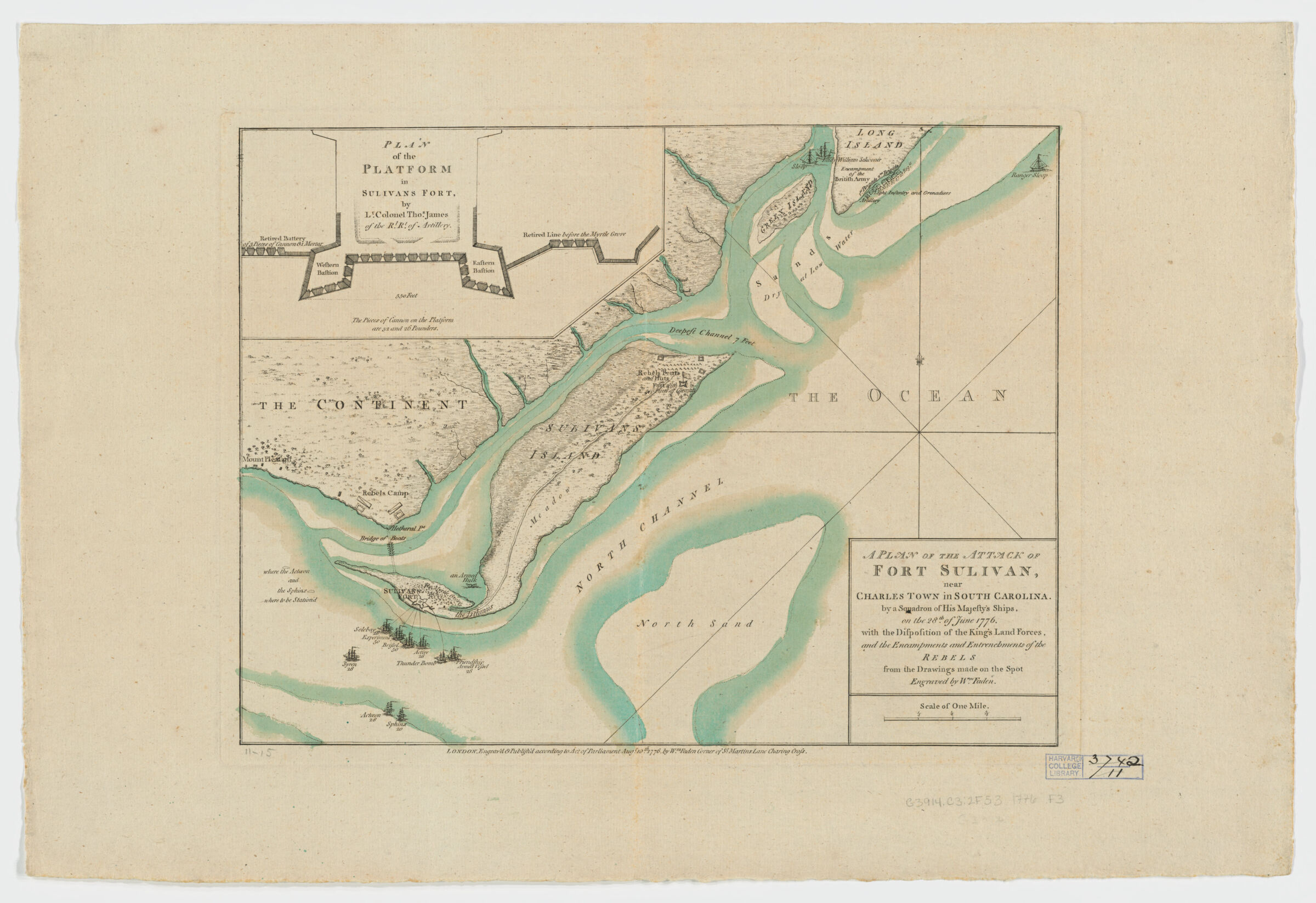
A plan of the attack of Fort Sulivan, near Charles Town in South Carolina ; Fort Sulivan, near Charles Town in South Carolina ; by a squadron of His Majesty's ships, on the 28th of June 1776, with the disposition of the King's land forces, and the encampments and entrenchments of the rebels from the drawings made on the spot
Shows British squadron including names of vessels, esp. "bridge of boats" at Hetheral pt.", rebel camps, and vegetation. Depths shown by soundings. Cf. LC Maps of North America, 1750-1789, 1545-1547 for similar printings. Inset: Plan of the platform in Sulivans Fort / by Lt. Colonel Thos. James of the Rl. Rt. of Artillery. Below lower margin: "London. Engrav'd & Publish'd according to Acto of Parliament Aug.t 10 th. 1776 by Wm. Faden corner of St. Martins Lane Charing Cross." Includes description of symbols for where the Actoeon and the Sphinx were to be Stationed. Available also as a digital image through the Harvard University Web site. Electronic reproduction. Cambridge, Mass. : Harvard College Library Digital Imaging Group, 2005. Harvard Map Collection digital maps. Revolutionary War Maps.