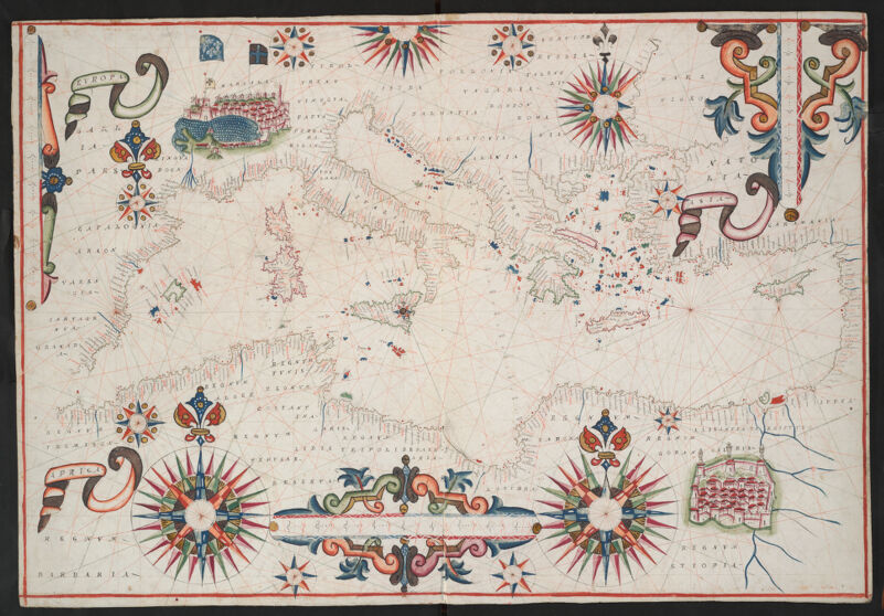
Shows the location of ports, coastal features, rhumb lines, and other navigational aids. Title supplied by cataloger. Pen-and-ink and watercolor with illumination. On vellum. Available also as a digital image through the Harvard University Library Web site. Place names in Italian and Latin. Electronic reproduction. Cambridge, Mass. : Harvard Geospatial Library, 2014. Georeferenced image for use in a GIS.
Shows the location of ports, coastal features, rhumb lines, and other navigational aids. Title supplied by cataloger. Pen-and-ink and watercolor with illumination. On vellum. Available also as a digital image through the Harvard University Library Web site. Place names in Italian and Latin. Electronic reproduction. Cambridge, Mass. : Harvard Geospatial Library, 2014. Georeferenced image for use in a GIS.