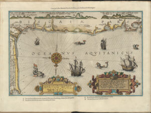
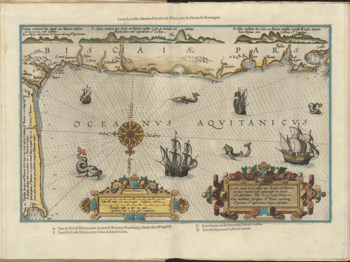
Carte vande zee custen van Arcason ende Biscaien met heure hauenen ende opdoeninghe van landen ende geberchton ; Carte des costes marines d'Accason & Biscaie avec ses Haures & Montaignes ; Du miroir de la navigation
Waghenaer, Lucas Janszoon, 1534 or 5-1606. Waghenaer, Lucas Janszoon, 1534 or 1535-1606, creator
Covers northern coast of Spain and southwestern France. Relief shown pictorially. Depths shown by soundings. Oriented with north toward the bottom. Includes index to points of interest, decorative cartouche, ill. of ships and sea monsters Available also as a digital image through the Harvard University Library Web site. Title and index in Dutch and French.
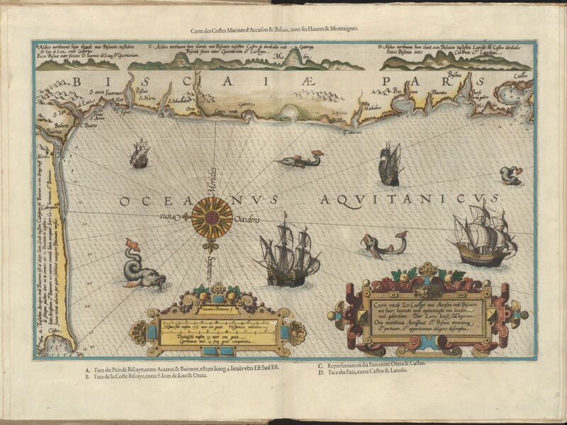
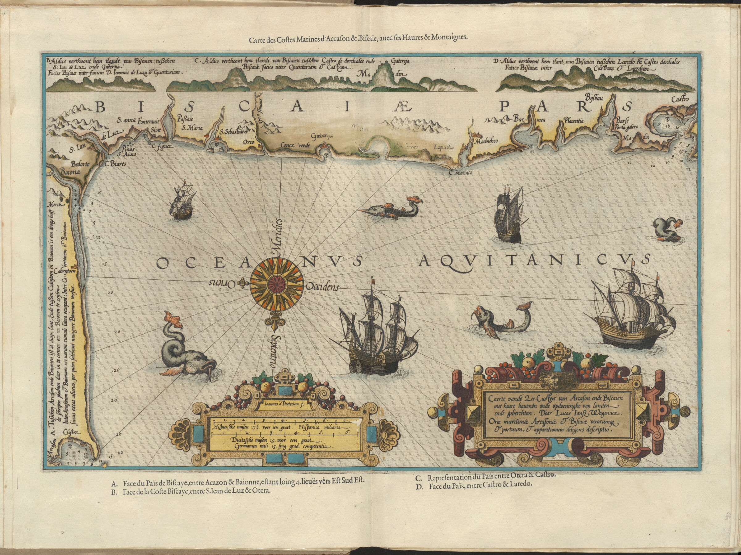
Carte vande zee custen van Arcason ende Biscaien met heure hauenen ende opdoeninghe van landen ende geberchton ; Carte des costes marines d'Accason & Biscaie avec ses Haures & Montaignes ; Du miroir de la navigation
Creator / Contributor
Waghenaer, Lucas Janszoon, 1534 or 5-1606. Waghenaer, Lucas Janszoon, 1534 or 1535-1606, creator
Covers northern coast of Spain and southwestern France. Relief shown pictorially. Depths shown by soundings. Oriented with north toward the bottom. Includes index to points of interest, decorative cartouche, ill. of ships and sea monsters Available also as a digital image through the Harvard University Library Web site. Title and index in Dutch and French.