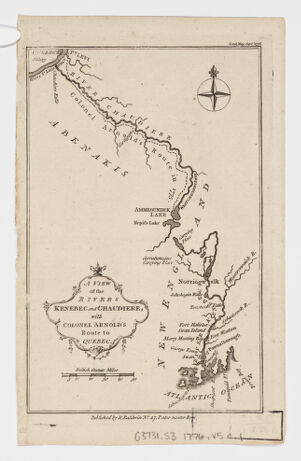
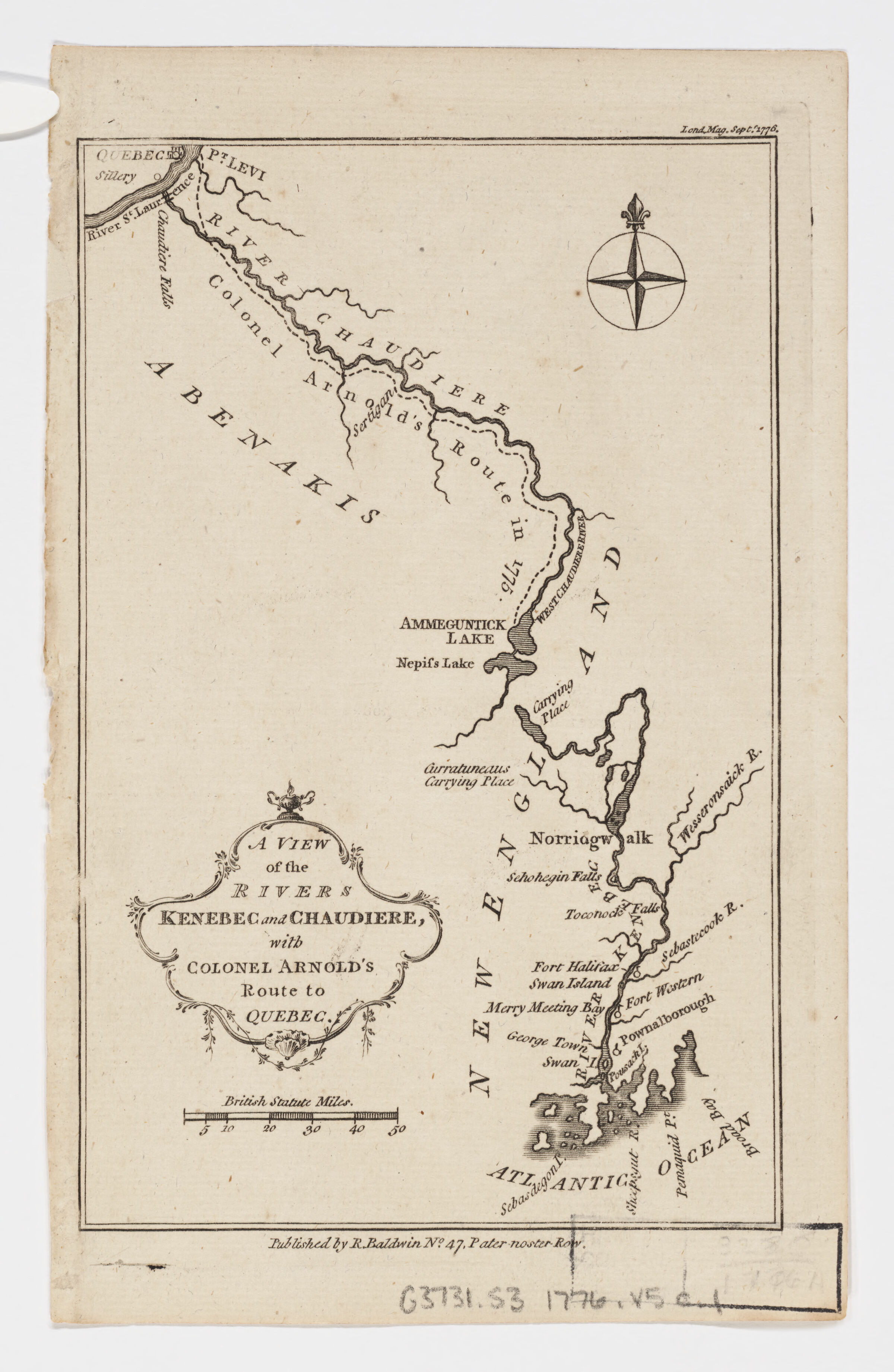
Title
A view of the rivers Kenebec and Chaudiere ; Rivers Kenebec and Chaudiere ; Colonel Arnold's route to Quebec ; with Colonel Arnold's route to Quebec
Creator / Contributor
Baldwin, R. (Robert), 1737-1810, pbl
Date
1776
Place of Origin
England [London]
Publisher
R. Baldwin, No. 47, Pater-noster Row
Extent
1 map ; 18 x 12 cm.
Language
English
Genre
map Maps Early works to 1800
Digital Format
Images
Subjects
Arnold, Benedict Canadian Invasion, 1775-1776--Maps--Early works to 1800 Maine--History--Revolution, 1775-1783--Campaigns--Maps Canada--History--1775-1783--Maps--Early works to 1800 United States--History--Revolution, 1775-1783--Campaigns--Québec (Province)--Maps--Early works to 1800 Québec (Québec)--History--Siege, 1775-1776--Maps--Early works to 1800 Kennebec River (Me.)--Maps--Early works to 1800 Chaudière River (Québec)--Maps--Early works to 1800
Notes
Shows route followed by the American expedition of 1775-1776 under Benedict Arnold against Quebec City.
Series
Harvard Map Collection digital maps
Repository
Harvard Map Collection, Harvard University
Record ID
990095394150203941