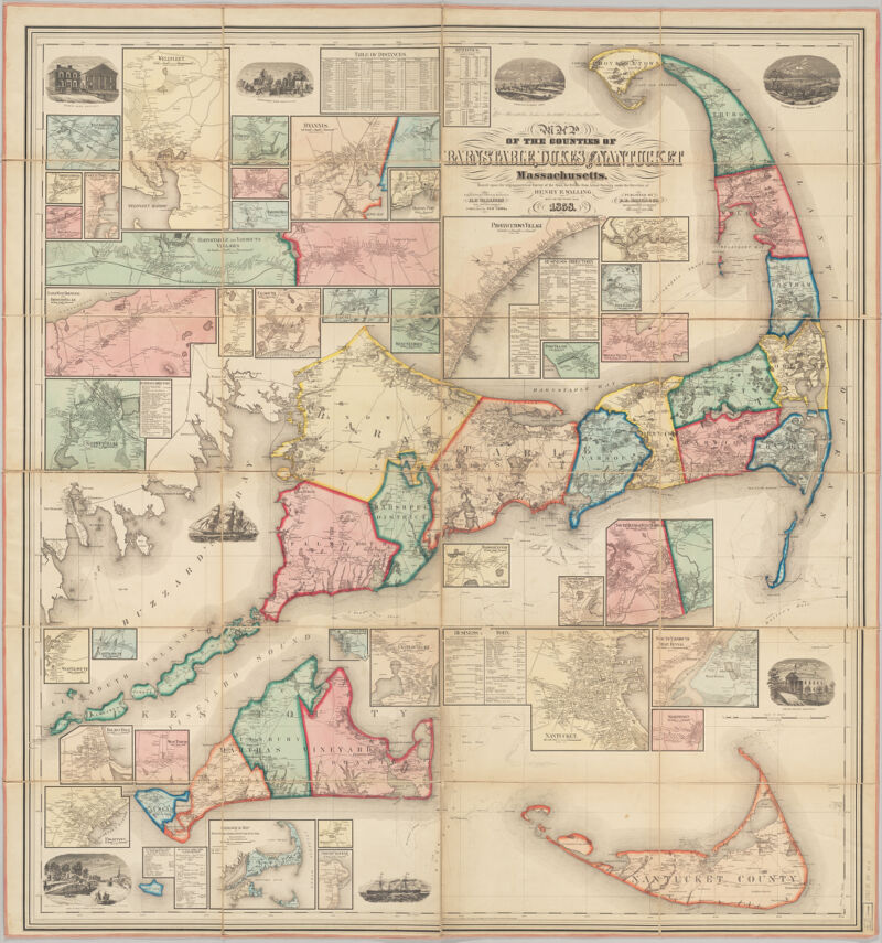
Shows buildings with names of property owners. Relief shown by hachures. "Engraved, printed, colored & mounted at H.F. Wallings Map Establishment." Includes many cadastral insets of individual county towns and geological inset map of counties. Includes also ill., business directories, and tables of statistics and distances. Available also as a digital image through the Harvard University Web site. Electronic reproduction. Cambridge, Mass. : Harvard Geospatial Library, 2006. Georeferenced image for use in a GIS.
Shows buildings with names of property owners. Relief shown by hachures. "Engraved, printed, colored & mounted at H.F. Wallings Map Establishment." Includes many cadastral insets of individual county towns and geological inset map of counties. Includes also ill., business directories, and tables of statistics and distances. Available also as a digital image through the Harvard University Web site. Electronic reproduction. Cambridge, Mass. : Harvard Geospatial Library, 2006. Georeferenced image for use in a GIS.