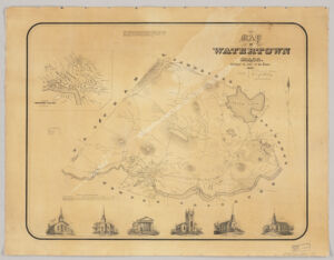
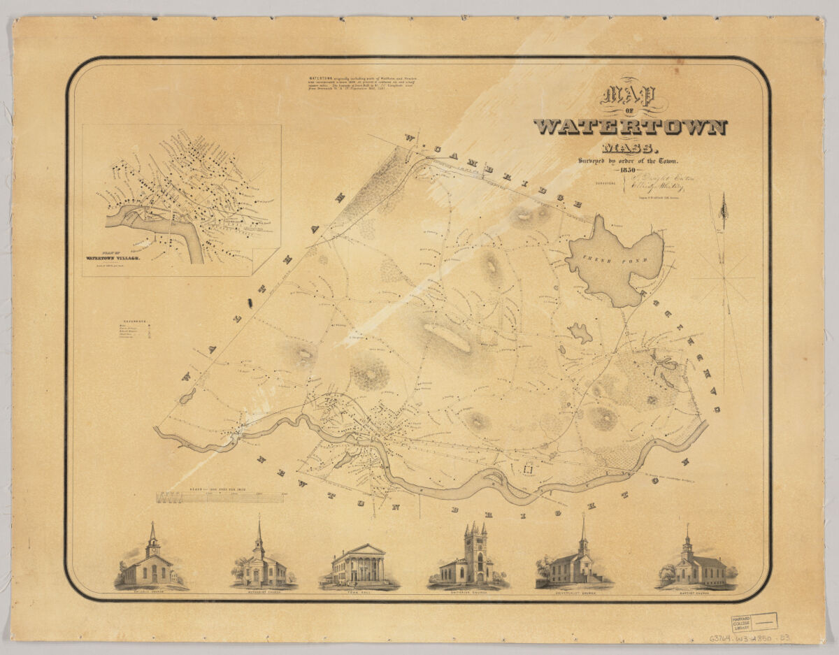
Shows buildings with names of property owners. Relief shown by hachures. Inset: Plan of Watertown Village. Scale [1:6,000]. Includes 6 views of town buildings. Available also as a digital image through the Harvard University Web site. Electronic reproduction. Cambridge, Mass. : Harvard Geospatial Library, 2006. Georeferenced image for use in a GIS.
Shows buildings with names of property owners. Relief shown by hachures. Inset: Plan of Watertown Village. Scale [1:6,000]. Includes 6 views of town buildings. Available also as a digital image through the Harvard University Web site. Electronic reproduction. Cambridge, Mass. : Harvard Geospatial Library, 2006. Georeferenced image for use in a GIS.