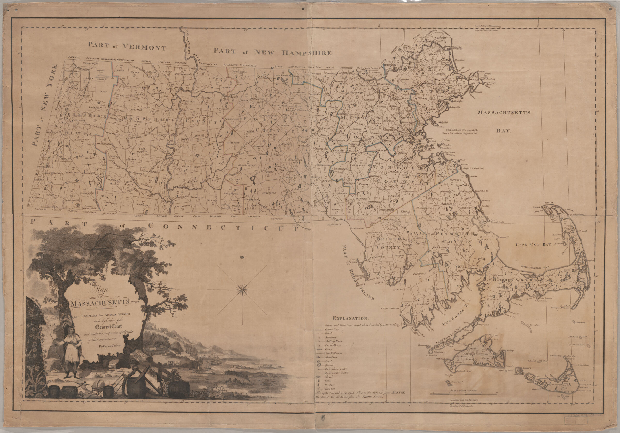
Shows distance of each town from Boston and the shire town. Colored in outline showing counties. "Vignette drawn by G. Graham." Prime meridians: Washington and London. Available also as a digital image through the Harvard University Web site. Electronic reproduction. Cambridge, Mass. : Harvard Geospatial Library, 2006. Georeferenced image for use in a GIS.
Shows distance of each town from Boston and the shire town. Colored in outline showing counties. "Vignette drawn by G. Graham." Prime meridians: Washington and London. Available also as a digital image through the Harvard University Web site. Electronic reproduction. Cambridge, Mass. : Harvard Geospatial Library, 2006. Georeferenced image for use in a GIS.