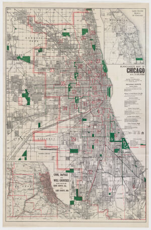
Shows, names of streets, drainage, roads, railroads, and other points of interest, ward boundaries in red. Includes insets:"Lake shore north of Chicago --Cook, Dupage, and Will counties, also parts of Kane County, Ill., and Lake County, Ind." Available also as a digital image through the Harvard University Web site. Electronic reproduction. Cambridge, Mass. : Harvard Geospatial Library, 2008 Georeferenced image for use in a GIS.
Shows, names of streets, drainage, roads, railroads, and other points of interest, ward boundaries in red. Includes insets:"Lake shore north of Chicago --Cook, Dupage, and Will counties, also parts of Kane County, Ill., and Lake County, Ind." Available also as a digital image through the Harvard University Web site. Electronic reproduction. Cambridge, Mass. : Harvard Geospatial Library, 2008 Georeferenced image for use in a GIS.