- Title
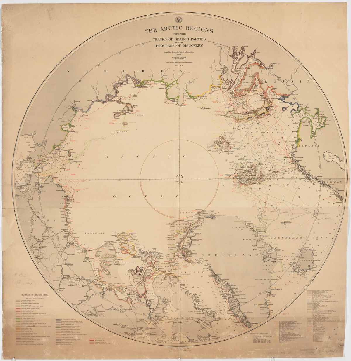
- The Arctic Regions with the tracks of search parties and the progress of discovery, compiled from the latest information
- United States, Hydrographic Office., creator
Noetzel, Gregor.
Roberts, A.C.
Littlehales, G. W. (George Washington), 1860-1943
Sigsbee, Charles D. (Charles Dwight), 1845-1923
United States, Navy Department., Bureau of Navigation. - U.S. Department of the Navy, Bureau of Navigation ; Charles D. Sigsbee, Commander, U.S.N. Hydrographer ; Division of Chart Construction, G. W. Littlehales, Assistant in Charge ; compiled by A.C. Roberts, Lithographed by Gr. Noetzel.
- 1896
- District of Columbia
Washington, D.C - Hydrographic Office
- 1 map : col. 101 cm. in diameter, on sheet 107 x 104 cm.
- English
- map
government publication
Maps - Images
- Discoveries in geography--19th century
Arctic Regions--Discovery and exploration--Maps - Shows exploration from 1734-1894.
Relief shown by spot heights and hachures. Depths shown by soundings.
"No. 1531."
Includes index to expeditions. - Open Collections Program at Harvard University
- Harvard Map Collection, Harvard University
- 990115394600203941
- Title
- The Arctic Regions with the tracks of search parties and the progress of discovery, compiled from the latest information
- Creator / Contributor
- United States, Hydrographic Office., creator
Noetzel, Gregor.
Roberts, A.C.
Littlehales, G. W. (George Washington), 1860-1943
Sigsbee, Charles D. (Charles Dwight), 1845-1923
United States, Navy Department., Bureau of Navigation. - Attribution
- U.S. Department of the Navy, Bureau of Navigation ; Charles D. Sigsbee, Commander, U.S.N. Hydrographer ; Division of Chart Construction, G. W. Littlehales, Assistant in Charge ; compiled by A.C. Roberts, Lithographed by Gr. Noetzel.
- Date
- 1896
- Place of Origin
- District of Columbia
Washington, D.C - Publisher
- Hydrographic Office
- Extent
- 1 map : col. 101 cm. in diameter, on sheet 107 x 104 cm.
- Language
- English
- Genre
- map
government publication
Maps - Digital Format
- Images
- Subjects
- Discoveries in geography--19th century
Arctic Regions--Discovery and exploration--Maps - Notes
- Shows exploration from 1734-1894.
Relief shown by spot heights and hachures. Depths shown by soundings.
"No. 1531."
Includes index to expeditions. - Series
- Open Collections Program at Harvard University
- Repository
- Harvard Map Collection, Harvard University
- Record ID
- 990115394600203941
Tools & Related Links
- More item details
- HOLLIS Record
Contacts
-
Joseph deVeerLibrary Project Manager and Museum LiaisonErnst Mayr Library617-495-3946
-