- Title
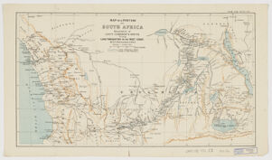
- Map of a portion of South Africa ; illustrative of Lieut. Cameron's route from lake Tangayika to the west coast
- Ravenstein, Ernst Georg, 1834-1913, creator
Royal Geographical Society (Great Britain) - by E. G. Ravenstein, F.R.G.S.
- 1876
- England
[London] - Geogr. Mag.
- 1 map : col. ; 25 x 45 cm.
- English
- map
Maps - Images
- Cameron, Verney Lovett--Travel--Maps
South Africa--Discovery and explorations - Relief shown by shading.
Above upper right margin: Geogr. Mag. March 1876.
Electronic reproduction. Cambridge, Mass. : Harvard Geospatial Library, 2014. Georeferenced image for use in a GIS. - Open Collections Program at Harvard University
- Harvard Map Collection, Harvard University
- 990115387140203941
- Title
- Map of a portion of South Africa ; illustrative of Lieut. Cameron's route from lake Tangayika to the west coast
- Creator / Contributor
- Ravenstein, Ernst Georg, 1834-1913, creator
Royal Geographical Society (Great Britain) - Attribution
- by E. G. Ravenstein, F.R.G.S.
- Date
- 1876
- Place of Origin
- England
[London] - Publisher
- Geogr. Mag.
- Extent
- 1 map : col. ; 25 x 45 cm.
- Language
- English
- Genre
- map
Maps - Digital Format
- Images
- Subjects
- Cameron, Verney Lovett--Travel--Maps
South Africa--Discovery and explorations - Notes
- Relief shown by shading.
Above upper right margin: Geogr. Mag. March 1876.
Electronic reproduction. Cambridge, Mass. : Harvard Geospatial Library, 2014. Georeferenced image for use in a GIS. - Series
- Open Collections Program at Harvard University
- Repository
- Harvard Map Collection, Harvard University
- Record ID
- 990115387140203941
Tools & Related Links
- More item details
- HOLLIS Record
Contacts
-
Joseph deVeerLibrary Project Manager and Museum LiaisonErnst Mayr Library617-495-3946
-