- Title
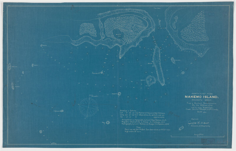
- Northeast Pass, Makemo Island, Paumotu group
- Moser, Jefferson F., creator
United States Fish Commission - from a sextant reconnaissance by the officers of U.S.F.C Stmr. Albatross, Comdr. Jeff'n F. Moser, U.S.N. Comd'g ; triangulation and topography by Lieut. Hugh Rodman, U.S.N. ; magnetic observations by Ensign A.J. Hepburn, U.S.N., hydrography by Lieut. Rodman and Ensign C.S. Kempff, U.S.N.
- 1899]
1899 - District of Columbia
[Washington, D.C - United States Fish Commissioner
- 1 map : blueprint ; 49 x 77 cm.
- English
- map
Maps - Images
- Albatross (Steamer)
Makemo (Tuamotu Archipelago)--Discovery and exploration--Maps - Depths shown by soundings.
"Approved Jeffy F. Moser. Commander U.S. Navy."
Electronic reproduction. Cambridge, Mass. : Harvard College Library Digital Imaging Group, 2008. (Open Collections Program at Harvard University. Expeditions and discoveries). Copy digitized: Harvard Map Collection: G9632.M33S12 1899.A4. - Open Collections Program at Harvard University
- Harvard Map Collection, Harvard University
- 990115226980203941
- Title
- Northeast Pass, Makemo Island, Paumotu group
- Creator / Contributor
- Moser, Jefferson F., creator
United States Fish Commission - Attribution
- from a sextant reconnaissance by the officers of U.S.F.C Stmr. Albatross, Comdr. Jeff'n F. Moser, U.S.N. Comd'g ; triangulation and topography by Lieut. Hugh Rodman, U.S.N. ; magnetic observations by Ensign A.J. Hepburn, U.S.N., hydrography by Lieut. Rodman and Ensign C.S. Kempff, U.S.N.
- Date
- 1899]
1899 - Place of Origin
- District of Columbia
[Washington, D.C - Publisher
- United States Fish Commissioner
- Extent
- 1 map : blueprint ; 49 x 77 cm.
- Language
- English
- Genre
- map
Maps - Digital Format
- Images
- Subjects
- Albatross (Steamer)
Makemo (Tuamotu Archipelago)--Discovery and exploration--Maps - Notes
- Depths shown by soundings.
"Approved Jeffy F. Moser. Commander U.S. Navy."
Electronic reproduction. Cambridge, Mass. : Harvard College Library Digital Imaging Group, 2008. (Open Collections Program at Harvard University. Expeditions and discoveries). Copy digitized: Harvard Map Collection: G9632.M33S12 1899.A4. - Series
- Open Collections Program at Harvard University
- Repository
- Harvard Map Collection, Harvard University
- Record ID
- 990115226980203941
Tools & Related Links
- More item details
- HOLLIS Record
Contacts
-
Joseph deVeerLibrary Project Manager and Museum LiaisonErnst Mayr Library617-495-3946
-