- Title
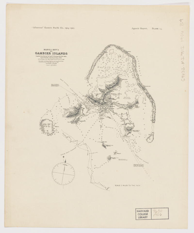
- Manga Reva or Gambier Islands ; Gambier Islands
- Beechey, Frederick William, 1796-1856, creator
Dumont d'Urville, Jules-Sébastien-César, 1790-1842 - compiled from surveys by Capt[n] F.W. Beechey, R.N.F.R.S. 1826 Capt[n] D'Urville of the French Navy 1838; with corrections from other French Govern[t] Surveys to 1881.
- 1906
- Massachusetts
Cambridge, Mass - printed for the Museum of the Comparative Zoology
- 1 map ; on sheet 31 x 25 cm.
- English
- map
government publication
Maps - Images
- Albatross (Steamer)
Nautical charts--French Polynesia--Mangareva
Gambier Islands (French Polynesia)--Discovery and exploration--Maps
Mangareva (French Polynesia)--Discovery and exploration--Maps
Tuamotu Archipelago (French Polynesia)--Discovery and exploration--Maps - Relief shown by hachures. Depths show by soundings.
At top of map: "'Albatross' Eastern Pacific Ex. 1904-1905. Agassiz Report. Plate 14".
Electronic reproduction. Cambridge, Mass. : Harvard Geospatial Library, 2014. Georeferenced image for use in a GIS. - Open Collections Program at Harvard University
- Harvard Map Collection, Harvard University
- 990115213790203941
- Title
- Manga Reva or Gambier Islands ; Gambier Islands
- Creator / Contributor
- Beechey, Frederick William, 1796-1856, creator
Dumont d'Urville, Jules-Sébastien-César, 1790-1842 - Attribution
- compiled from surveys by Capt[n] F.W. Beechey, R.N.F.R.S. 1826 Capt[n] D'Urville of the French Navy 1838; with corrections from other French Govern[t] Surveys to 1881.
- Date
- 1906
- Place of Origin
- Massachusetts
Cambridge, Mass - Publisher
- printed for the Museum of the Comparative Zoology
- Extent
- 1 map ; on sheet 31 x 25 cm.
- Language
- English
- Genre
- map
government publication
Maps - Digital Format
- Images
- Subjects
- Albatross (Steamer)
Nautical charts--French Polynesia--Mangareva
Gambier Islands (French Polynesia)--Discovery and exploration--Maps
Mangareva (French Polynesia)--Discovery and exploration--Maps
Tuamotu Archipelago (French Polynesia)--Discovery and exploration--Maps - Notes
- Relief shown by hachures. Depths show by soundings.
At top of map: "'Albatross' Eastern Pacific Ex. 1904-1905. Agassiz Report. Plate 14".
Electronic reproduction. Cambridge, Mass. : Harvard Geospatial Library, 2014. Georeferenced image for use in a GIS. - Series
- Open Collections Program at Harvard University
- Repository
- Harvard Map Collection, Harvard University
- Record ID
- 990115213790203941
Tools & Related Links
- More item details
- HOLLIS Record
Contacts
-
Joseph deVeerLibrary Project Manager and Museum LiaisonErnst Mayr Library617-495-3946
-