- Title
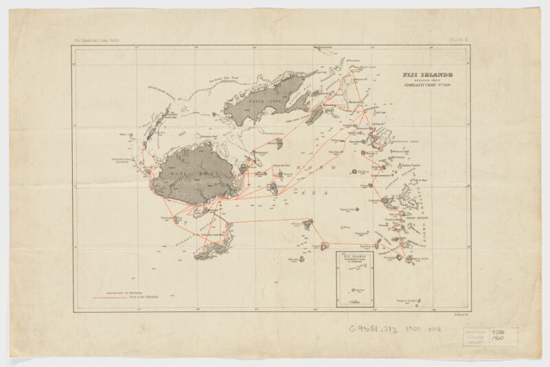
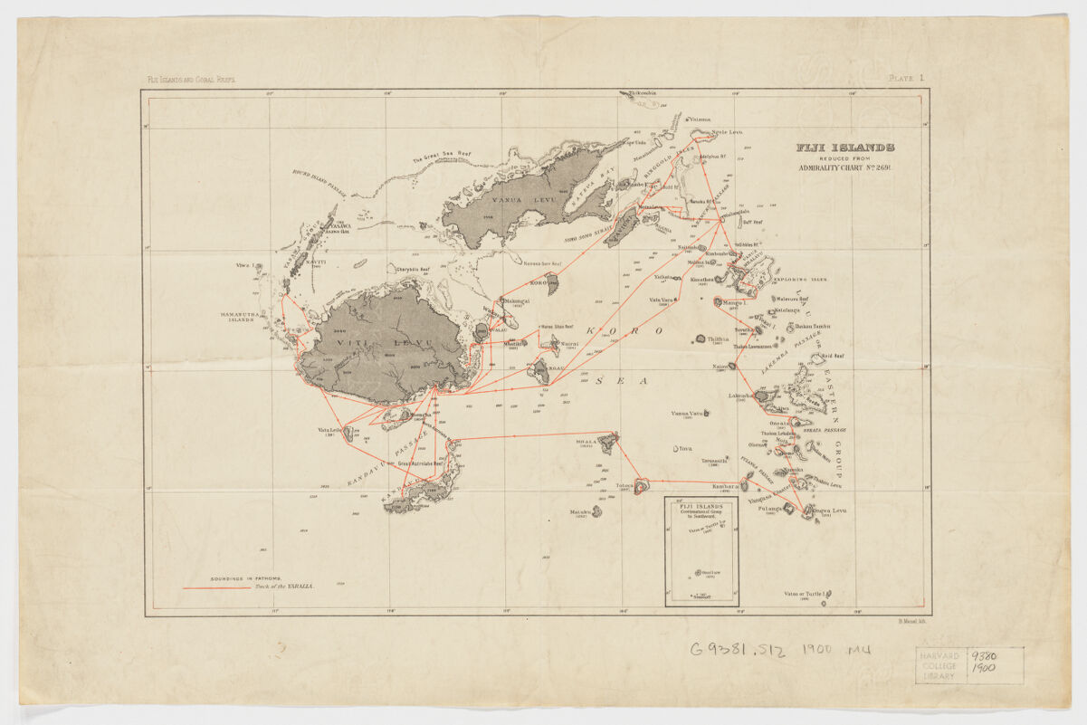
- Fiji Islands ; reduced from admirality chart no. 2691
- Meisel, Berthold., creator
- B. Meisel lith.
- 1900]
1900 - Massachusetts
[Boston? - B. Meisel
- 1 map : col. ; 21 x 32 cm.
- English
- map
Maps - Images
- Yaralla (Yacht)
Nautical charts--Fiji
Fiji--Discovery and exploration--Maps - Shows the track of the Yaralla.
Relief shown by spot heights. Depths shown by soundings.
Above upper margin: Fiji Islands and Coral Reefs. Plate I.
Inset: Fiji Islands: Continuation of group to southward.
Electronic reproduction. Cambridge, Mass. : Harvard Geospatial Library, 2014. Georeferenced image for use in a GIS. - Open Collections Program at Harvard University
- Harvard Map Collection, Harvard University
- 990115207130203941
- Title
- Fiji Islands ; reduced from admirality chart no. 2691
- Creator / Contributor
- Meisel, Berthold., creator
- Attribution
- B. Meisel lith.
- Date
- 1900]
1900 - Place of Origin
- Massachusetts
[Boston? - Publisher
- B. Meisel
- Extent
- 1 map : col. ; 21 x 32 cm.
- Language
- English
- Genre
- map
Maps - Digital Format
- Images
- Subjects
- Yaralla (Yacht)
Nautical charts--Fiji
Fiji--Discovery and exploration--Maps - Notes
- Shows the track of the Yaralla.
Relief shown by spot heights. Depths shown by soundings.
Above upper margin: Fiji Islands and Coral Reefs. Plate I.
Inset: Fiji Islands: Continuation of group to southward.
Electronic reproduction. Cambridge, Mass. : Harvard Geospatial Library, 2014. Georeferenced image for use in a GIS. - Series
- Open Collections Program at Harvard University
- Repository
- Harvard Map Collection, Harvard University
- Record ID
- 990115207130203941
Tools & Related Links
- More item details
- HOLLIS Record
Contacts
-
Joseph deVeerLibrary Project Manager and Museum LiaisonErnst Mayr Library617-495-3946
-