- Title
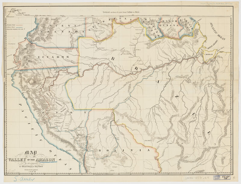
- Map of the valley of the Amazon ; to accompany Lt. Herndon's report
- Elliott, H. C., creator
Herndon, William Lewis, 1813-1857
A. Hoen & Co - drawn by H.C. Elliot.
- [1853]
1853 - Maryland
Baltimore - A. Hoen
- 1 map : col. ; 45 x 60 cm.
- English
- map
Maps - Images
- Amazon Basin--Maps
- Detached from: Senate, Ex. Doc. No. 36, 2d Sess. 32d Congress.
Verified in: Catalogue of Maps of Hispanic America, American Geographical Society, vol. 3, p. 123, no. 1853-a (1).
Relief shown by hachures.
Includes vertical section of route from Callo to Pará.
Also available online.
Electronic reproduction. Cambridge, Mass. : Harvard Geospatial Library, 2011. Georeferenced image for use in a GIS. - Open Collections Program at Harvard University
- Harvard Map Collection, Harvard University
- 990115205490203941
- Title
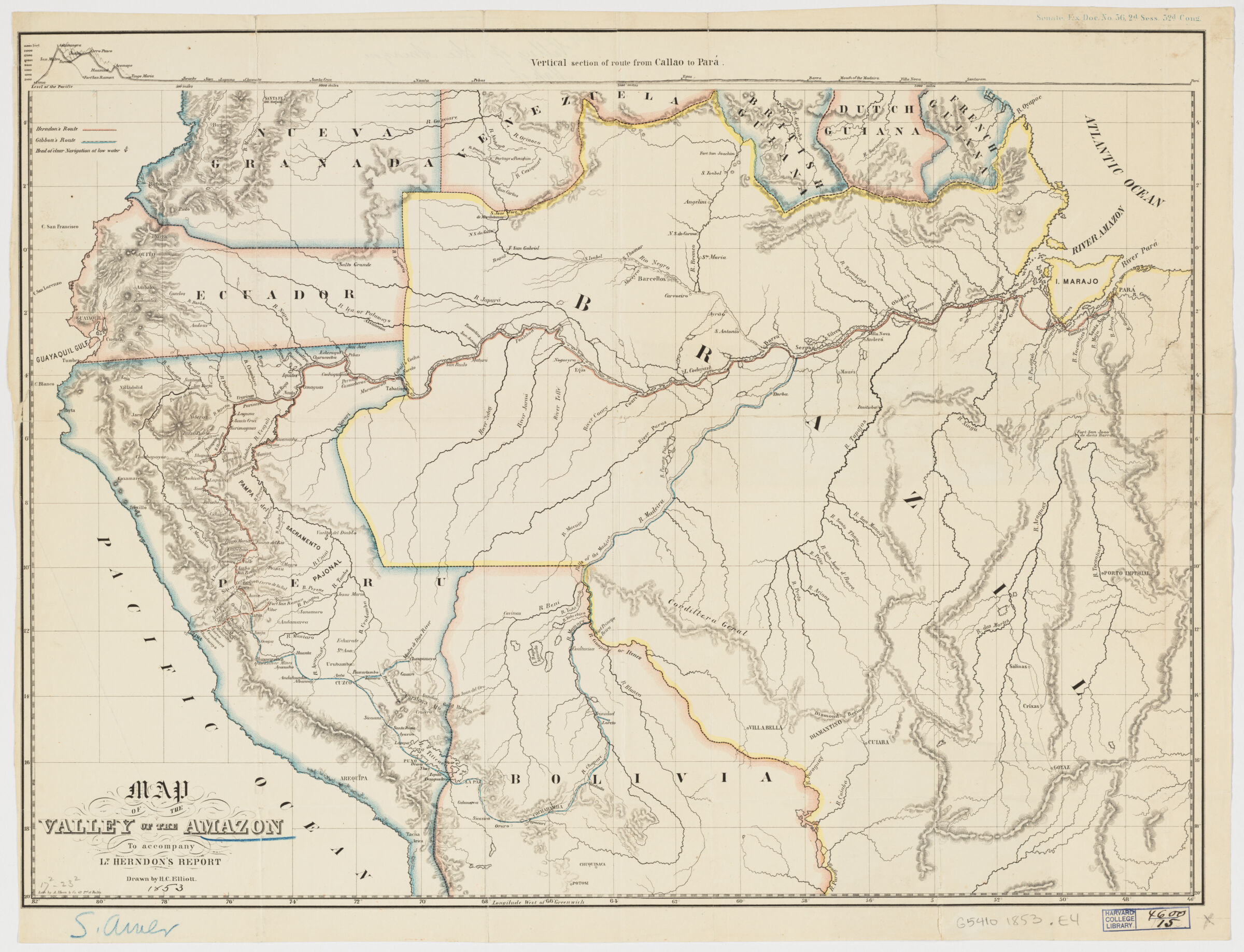
- Map of the valley of the Amazon ; to accompany Lt. Herndon's report
- Creator / Contributor
- Elliott, H. C., creator
Herndon, William Lewis, 1813-1857
A. Hoen & Co - Attribution
- drawn by H.C. Elliot.
- Date
- [1853]
1853 - Place of Origin
- Maryland
Baltimore - Publisher
- A. Hoen
- Extent
- 1 map : col. ; 45 x 60 cm.
- Language
- English
- Genre
- map
Maps - Digital Format
- Images
- Subjects
- Amazon Basin--Maps
- Notes
- Detached from: Senate, Ex. Doc. No. 36, 2d Sess. 32d Congress.
Verified in: Catalogue of Maps of Hispanic America, American Geographical Society, vol. 3, p. 123, no. 1853-a (1).
Relief shown by hachures.
Includes vertical section of route from Callo to Pará.
Also available online.
Electronic reproduction. Cambridge, Mass. : Harvard Geospatial Library, 2011. Georeferenced image for use in a GIS. - Series
- Open Collections Program at Harvard University
- Repository
- Harvard Map Collection, Harvard University
- Record ID
- 990115205490203941
Tools & Related Links
- More item details
- HOLLIS Record
Contacts
-
Joseph deVeerLibrary Project Manager and Museum LiaisonErnst Mayr Library617-495-3946
-