- Title
- Physikalische Wandkarte von Afrika
- Chavanne, Josef, 1846-1902, creator
Ed. Hölzel (Firm) - entworfen und gezeichnet von Josef Chavanne ; ausgeführt in Eduard Hölzel's geogr. Institut.
- [1878]
1878 - Austria
Wien - Verlag von Ed. Hölzel
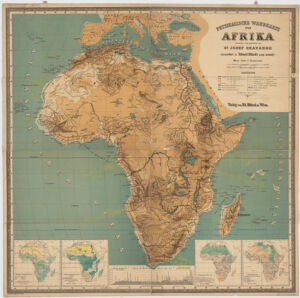
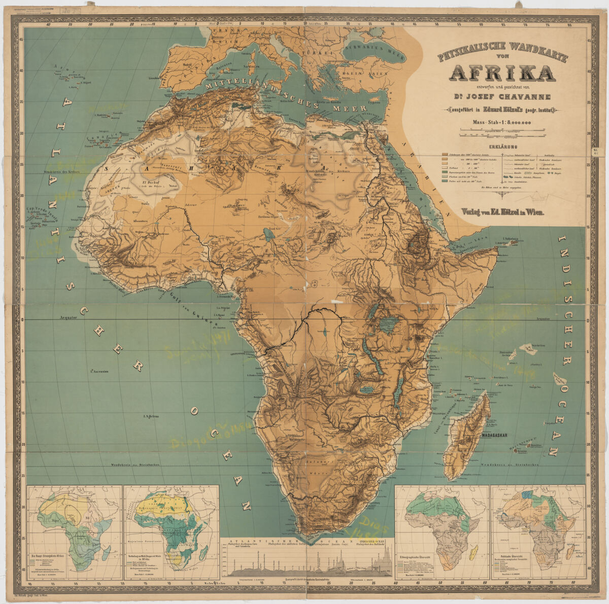
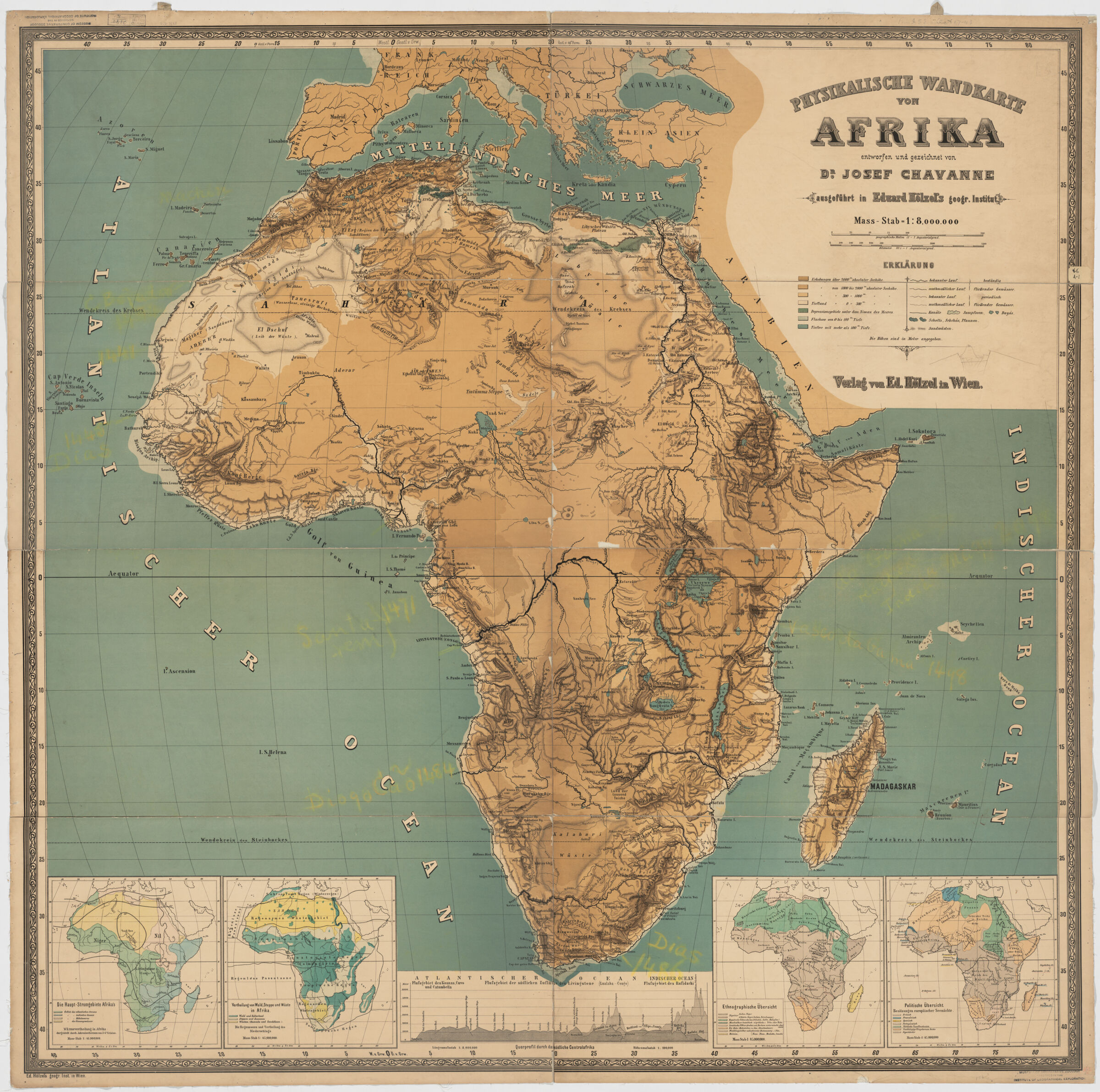
- 1 map : col. ; 122 x 122 cm.
- German
- map
Maps - Images
- Africa--Discovery and exploration--Maps
- Relief shown by gradient tints, hachures, and spot heights.
Includes profile and 4 inset maps (scale 1:45,000,000): Die Haupt-Stromgebiete Afrika's -- Vertheilung von Wald, Steppe und Wüste in Afrika -- Ethnographische Übersicht -- Politische Übersicht. - Open Collections Program at Harvard University
- Harvard Map Collection, Harvard University
- 990115203660203941
- Title
- Physikalische Wandkarte von Afrika
- Creator / Contributor
- Chavanne, Josef, 1846-1902, creator
Ed. Hölzel (Firm) - Attribution
- entworfen und gezeichnet von Josef Chavanne ; ausgeführt in Eduard Hölzel's geogr. Institut.
- Date
- [1878]
1878 - Place of Origin
- Austria
Wien - Publisher
- Verlag von Ed. Hölzel
- Extent
- 1 map : col. ; 122 x 122 cm.
- Language
- German
- Genre
- map
Maps - Digital Format
- Images
- Subjects
- Africa--Discovery and exploration--Maps
- Notes
- Relief shown by gradient tints, hachures, and spot heights.
Includes profile and 4 inset maps (scale 1:45,000,000): Die Haupt-Stromgebiete Afrika's -- Vertheilung von Wald, Steppe und Wüste in Afrika -- Ethnographische Übersicht -- Politische Übersicht. - Series
- Open Collections Program at Harvard University
- Repository
- Harvard Map Collection, Harvard University
- Record ID
- 990115203660203941
Tools & Related Links
- More item details
- HOLLIS Record
Contacts
-
Joseph deVeerLibrary Project Manager and Museum LiaisonErnst Mayr Library617-495-3946
-