- Title
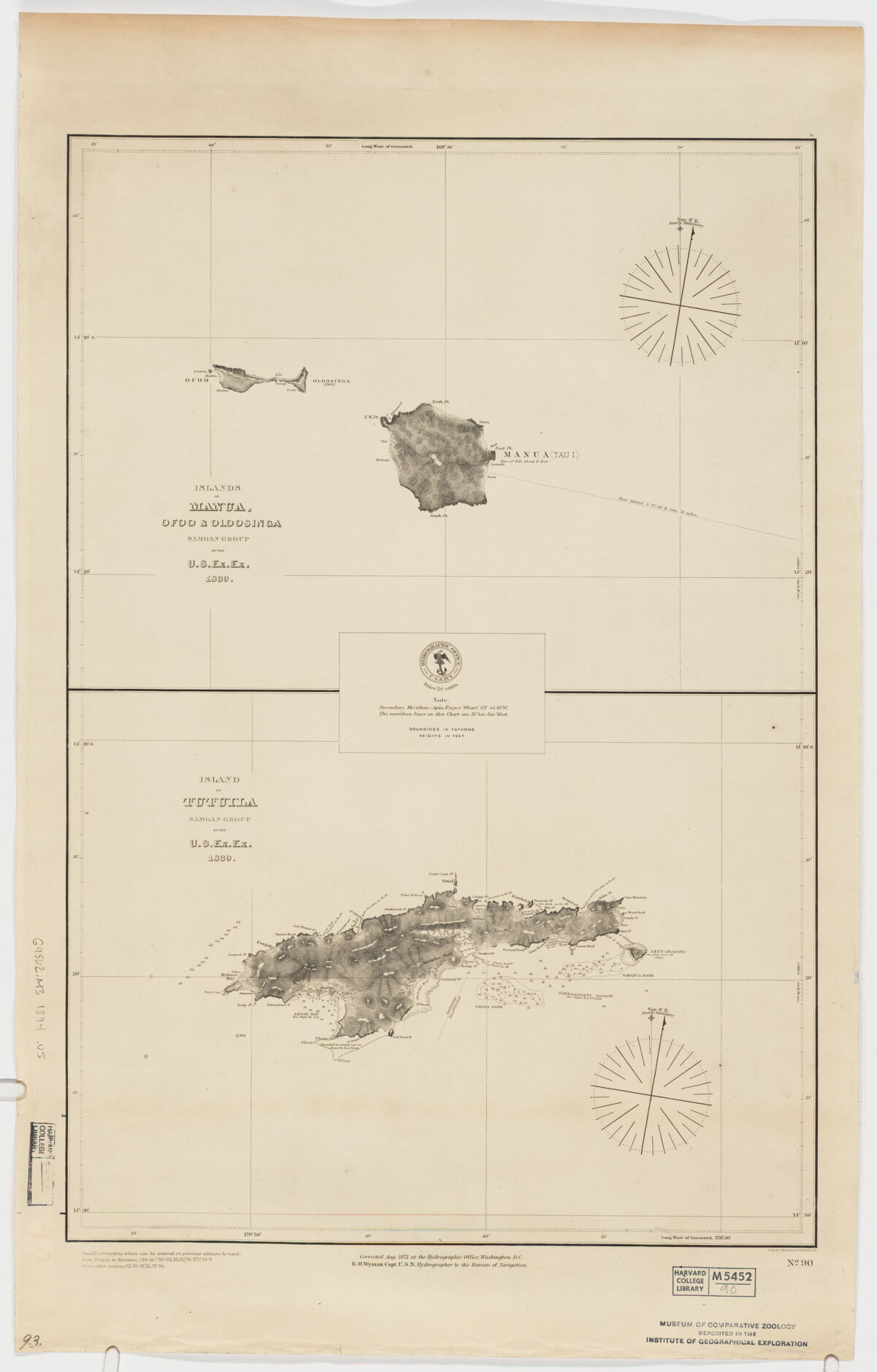
- Islands of Manua, Ofoo & Oloosinga, Samoan Group. Island of Tutuila, Samoan Group ; Island of Tutuila, Samoan Group
- United States, Hydrographic Office., creator
Wyman, R. H. (Robert Harris), 1822-1882
Sherman & Smith
United States Exploring Expedition (1838-1842) - by the U.S. Ex. Ex. 1839; corrected Aug. 1871 ... R.H. Wyman Capt. U.S.N. Hydrographer to the Bureau of Navigation; eng. Sherman & Smith, N.Y.
- [1894]
1894 - District of Columbia
Washington, D.C - Hydrographic Office
- [Ed. of 1894]
- 2 maps on 1 sheet ; each 29 x 39 cm., on sheet 72 x 46 cm.
- English
- map
government publication
Maps - Images
- Nautical charts--American Samoa
Manua Islands (American Samoa)--Discovery and exploration--Maps
Tutuila Island (American Samoa)--Discovery and exploration--Maps - Relief shown by hachures. Depths shown by soundings.
Notes on sources and editions dated to 1894.
"No. 90". - Open Collections Program at Harvard University
Harvard Map Collection digital maps - Harvard Map Collection, Harvard University
- 990115166120203941
- Title
- Islands of Manua, Ofoo & Oloosinga, Samoan Group. Island of Tutuila, Samoan Group ; Island of Tutuila, Samoan Group
- Creator / Contributor
- United States, Hydrographic Office., creator
Wyman, R. H. (Robert Harris), 1822-1882
Sherman & Smith
United States Exploring Expedition (1838-1842) - Attribution
- by the U.S. Ex. Ex. 1839; corrected Aug. 1871 ... R.H. Wyman Capt. U.S.N. Hydrographer to the Bureau of Navigation; eng. Sherman & Smith, N.Y.
- Date
- [1894]
1894 - Place of Origin
- District of Columbia
Washington, D.C - Publisher
- Hydrographic Office
- Edition
- [Ed. of 1894]
- Extent
- 2 maps on 1 sheet ; each 29 x 39 cm., on sheet 72 x 46 cm.
- Language
- English
- Genre
- map
government publication
Maps - Digital Format
- Images
- Subjects
- Nautical charts--American Samoa
Manua Islands (American Samoa)--Discovery and exploration--Maps
Tutuila Island (American Samoa)--Discovery and exploration--Maps - Notes
- Relief shown by hachures. Depths shown by soundings.
Notes on sources and editions dated to 1894.
"No. 90". - Series
- Open Collections Program at Harvard University
Harvard Map Collection digital maps - Repository
- Harvard Map Collection, Harvard University
- Record ID
- 990115166120203941
Tools & Related Links
- More item details
- HOLLIS Record
Contacts
-
Joseph deVeerLibrary Project Manager and Museum LiaisonErnst Mayr Library617-495-3946
-