- Title
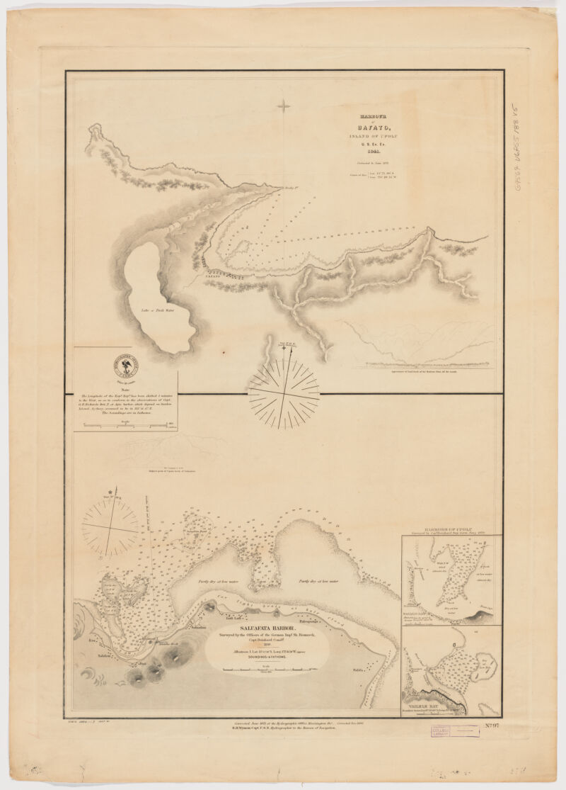
- Harbour of Uafato, Island of Upolu. Saluafata Harbor ; Saluafata Harbor
- United States, Hydrographic Office., creator
Wyman, R. H. (Robert Harris), 1822-1882
United States Exploring Expedition (1838-1842) - by the U.S. Ex. Ex. 1841; corrected to June 1871; R.H. Wyman Capt. U.S.N. Hydrographer to the Bureau of Navigation.
- 1880
- District of Columbia
Washington, D.C - Hydrographic Office
- Cor. Nov. 1880.
- 2 maps on 1 sheet ; 72 x 51 cm., each map 29 x 39 cm.
- English
- map
government publication
Maps - Images
- Bismarck (Battleship)--Travel--Maps
Harbors--Samoa--Upolu--Discovery and exploration--Maps
Nautical charts--Samoa--Upolu
Upolu (Samoa)--Discovery and exploration--Maps - Relief shown by hachures. Depths shown by soundings.
Insets: Harbours of Upolu / surveyed by Cap[t] Deinhard Imp. Germ. Navy 1879 -- Vailele Bay.
Includes 1 profile view.
Includes note.
"No. 97".
For map of Saluafata Harbor: "Surveyed by the Officers of the German Imp[l] Sh. Bismarck, Capt. Deinhard Comd[g]. - Open Collections Program at Harvard University
Harvard Map Collection digital maps - Harvard Map Collection, Harvard University
- 990115162720203941
- Title
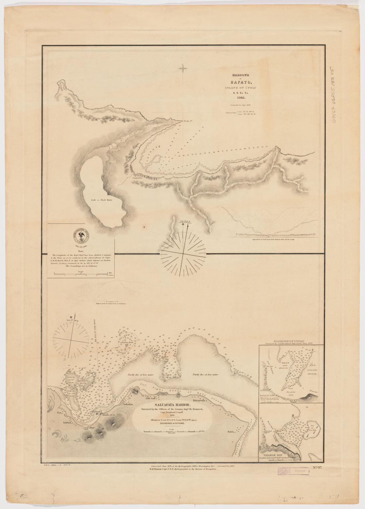
- Harbour of Uafato, Island of Upolu. Saluafata Harbor ; Saluafata Harbor
- Creator / Contributor
- United States, Hydrographic Office., creator
Wyman, R. H. (Robert Harris), 1822-1882
United States Exploring Expedition (1838-1842) - Attribution
- by the U.S. Ex. Ex. 1841; corrected to June 1871; R.H. Wyman Capt. U.S.N. Hydrographer to the Bureau of Navigation.
- Date
- 1880
- Place of Origin
- District of Columbia
Washington, D.C - Publisher
- Hydrographic Office
- Edition
- Cor. Nov. 1880.
- Extent
- 2 maps on 1 sheet ; 72 x 51 cm., each map 29 x 39 cm.
- Language
- English
- Genre
- map
government publication
Maps - Digital Format
- Images
- Subjects
- Bismarck (Battleship)--Travel--Maps
Harbors--Samoa--Upolu--Discovery and exploration--Maps
Nautical charts--Samoa--Upolu
Upolu (Samoa)--Discovery and exploration--Maps - Notes
- Relief shown by hachures. Depths shown by soundings.
Insets: Harbours of Upolu / surveyed by Cap[t] Deinhard Imp. Germ. Navy 1879 -- Vailele Bay.
Includes 1 profile view.
Includes note.
"No. 97".
For map of Saluafata Harbor: "Surveyed by the Officers of the German Imp[l] Sh. Bismarck, Capt. Deinhard Comd[g]. - Series
- Open Collections Program at Harvard University
Harvard Map Collection digital maps - Repository
- Harvard Map Collection, Harvard University
- Record ID
- 990115162720203941
Tools & Related Links
- More item details
- HOLLIS Record
Contacts
-
Joseph deVeerLibrary Project Manager and Museum LiaisonErnst Mayr Library617-495-3946
-