- Title
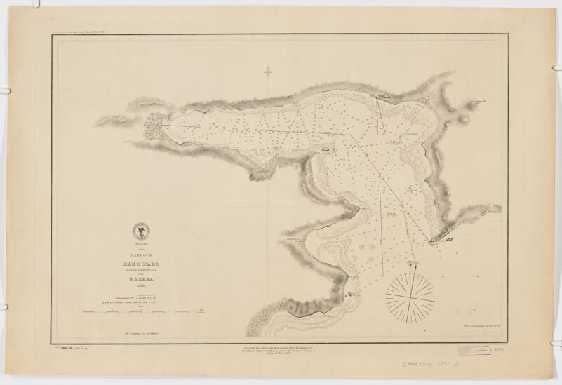
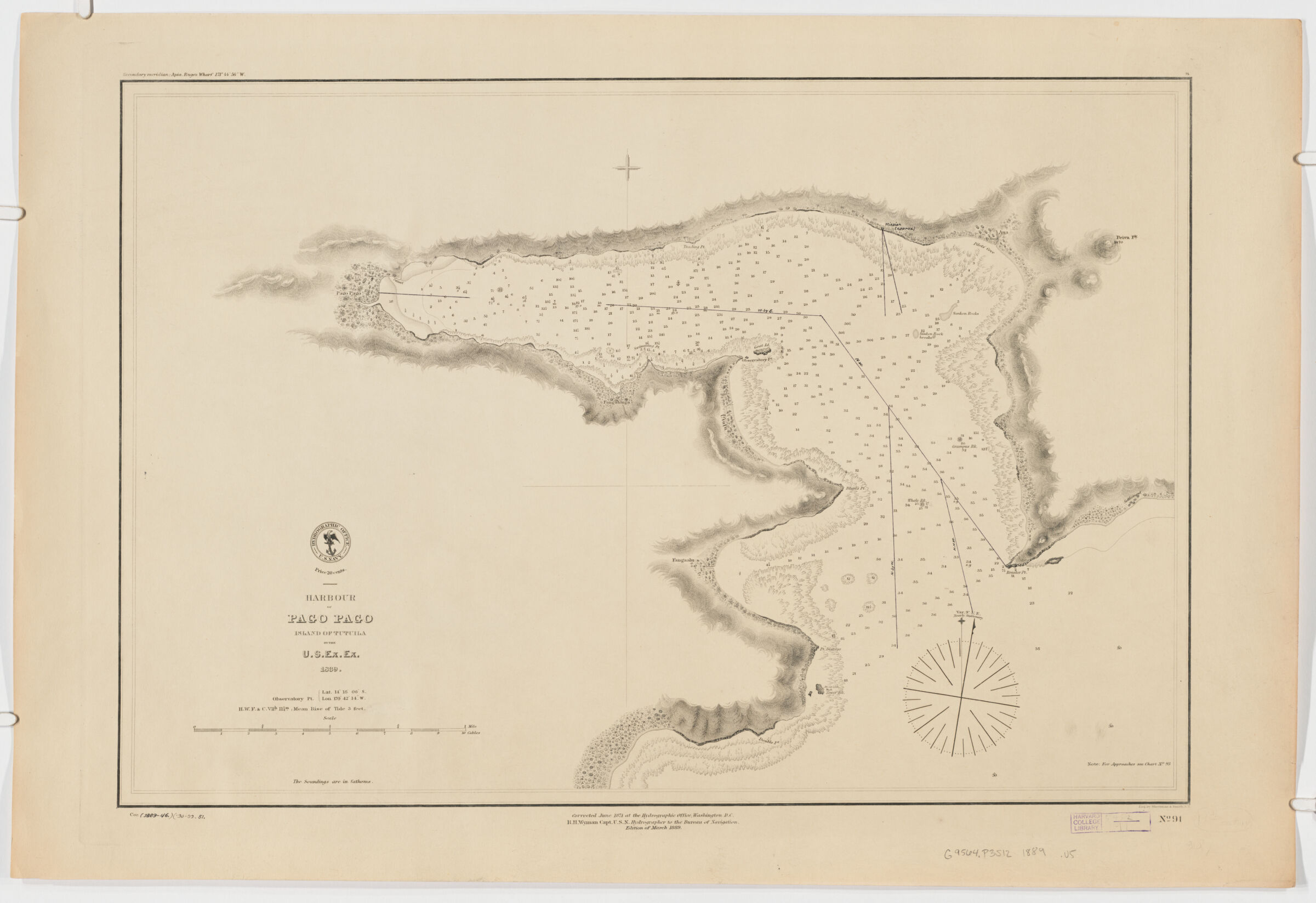
- Harbour of Pago Pago ; Island of Tutuila
- United States, Hydrographic Office., creator
Wyman, R. H. (Robert Harris), 1822-1882
Sherman & Smith
United States Exploring Expedition (1838-1842) - by U.S. Ex.Ex. 1839; corrected June 1871 ... R.H. Wyman Capt. U.S.N. Hydrographer to the Bureau of Navigation; eng. Sherman & Smith.
- 1889
- District of Columbia
Washington, D.C - Hydrographic Office
- Ed. of Mar. 1889.
- 1 map ; 39 x 58 cm.
- English
- map
government publication
Maps - Images
- Harbors--American Samoa--Pago Pago--Discovery and exploration--Maps
Nautical charts--American Samoa
Pago Pago (American Samoa)--Discovery and exploration--Maps
Tutuila Island (American Samoa)--Discovery and exploration--Maps - Relief shown by hachures. Depths shown by spot heights.
"No. 91".
Above upper left margin: "Secondary meridian: Apia ..."
Includes note: "For approaches see Chart No. 93." - Open Collections Program at Harvard University
Harvard Map Collection digital maps - Harvard Map Collection, Harvard University
- 990115153240203941
- Title
- Harbour of Pago Pago ; Island of Tutuila
- Creator / Contributor
- United States, Hydrographic Office., creator
Wyman, R. H. (Robert Harris), 1822-1882
Sherman & Smith
United States Exploring Expedition (1838-1842) - Attribution
- by U.S. Ex.Ex. 1839; corrected June 1871 ... R.H. Wyman Capt. U.S.N. Hydrographer to the Bureau of Navigation; eng. Sherman & Smith.
- Date
- 1889
- Place of Origin
- District of Columbia
Washington, D.C - Publisher
- Hydrographic Office
- Edition
- Ed. of Mar. 1889.
- Extent
- 1 map ; 39 x 58 cm.
- Language
- English
- Genre
- map
government publication
Maps - Digital Format
- Images
- Subjects
- Harbors--American Samoa--Pago Pago--Discovery and exploration--Maps
Nautical charts--American Samoa
Pago Pago (American Samoa)--Discovery and exploration--Maps
Tutuila Island (American Samoa)--Discovery and exploration--Maps - Notes
- Relief shown by hachures. Depths shown by spot heights.
"No. 91".
Above upper left margin: "Secondary meridian: Apia ..."
Includes note: "For approaches see Chart No. 93." - Series
- Open Collections Program at Harvard University
Harvard Map Collection digital maps - Repository
- Harvard Map Collection, Harvard University
- Record ID
- 990115153240203941
Tools & Related Links
- More item details
- HOLLIS Record
Contacts
-
Joseph deVeerLibrary Project Manager and Museum LiaisonErnst Mayr Library617-495-3946
-