- Title
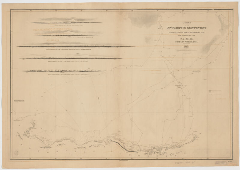
- Chart of the Antarctic continent ; shewing the icy barrier attached to it : discovered by the U.S. Ex. Ex. Charles Wilkes Esq. commander, 1840
- United States, Hydrographic Office., creator
Wilkes, Charles, 1798-1877
Sherman & Smith
United States Exploring Expedition (1838-1842) - 1890]
1890 - District of Columbia
[Washington - U.S. Hydrographic Office
- Ed. of Jan. 1890
- 1 map ; 58 x 87 cm.
- English
- map
Maps - Images
- Nautical charts--Antarctica--Discovery and exploration
Discoveries in geography--19th century
Antarctica--Maps - Relief shown by hachures. Depths shown by soundings.
Includes 5 profiles of Antarctic continent as seen by the U.S. ships Peacock and Vincennes.
"No. 170". - Open Collections Program at Harvard University
Harvard Map Collection digital maps - Harvard Map Collection, Harvard University
- 990115036220203941
- Title
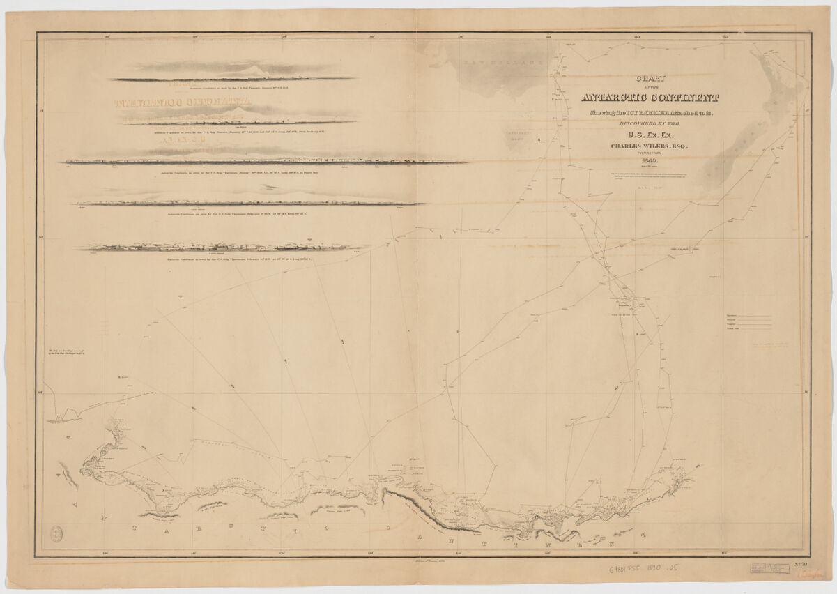
- Chart of the Antarctic continent ; shewing the icy barrier attached to it : discovered by the U.S. Ex. Ex. Charles Wilkes Esq. commander, 1840
- Creator / Contributor
- United States, Hydrographic Office., creator
Wilkes, Charles, 1798-1877
Sherman & Smith
United States Exploring Expedition (1838-1842) - Date
- 1890]
1890 - Place of Origin
- District of Columbia
[Washington - Publisher
- U.S. Hydrographic Office
- Edition
- Ed. of Jan. 1890
- Extent
- 1 map ; 58 x 87 cm.
- Language
- English
- Genre
- map
Maps - Digital Format
- Images
- Subjects
- Nautical charts--Antarctica--Discovery and exploration
Discoveries in geography--19th century
Antarctica--Maps - Notes
- Relief shown by hachures. Depths shown by soundings.
Includes 5 profiles of Antarctic continent as seen by the U.S. ships Peacock and Vincennes.
"No. 170". - Series
- Open Collections Program at Harvard University
Harvard Map Collection digital maps - Repository
- Harvard Map Collection, Harvard University
- Record ID
- 990115036220203941
Tools & Related Links
- More item details
- HOLLIS Record
Contacts
-
Joseph deVeerLibrary Project Manager and Museum LiaisonErnst Mayr Library617-495-3946
-