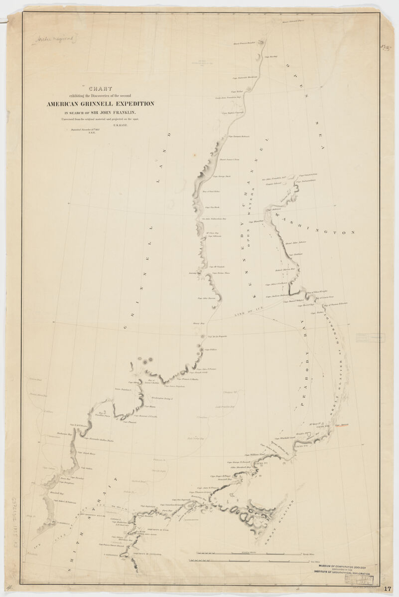
- Title
- Chart exhibiting the discoveries of the second American-Grinnell-Expedition in search of Sir John Franklin ; unrevised from the original material and projected on the spot
- Kane, Elisha Kent, 1820-1857, creator
Bien, Julius, 1826-1909 - E.K. Kane.
- [1855]
1853 - New York (State)
N[ew] Y[ork] - Lith of J. Bien
- 1 map ; 89 x 56 cm.
- English
- map
Maps - Images
- Franklin, John--Maps
Arctic regions--Discovery and exploration--Maps
Northwest Passage--Discovery and exploration--Maps - "Deposited Nov. 15th, 1855. - E.K.K."
Relief shown by hachures.
Covers Antarctic Peninsula.
Also available online.
Electronic reproduction. Cambridge, Mass. : Harvard Geospatial Library, 2011. Georeferenced image for use in a GIS. - Open Collections Program at Harvard University
- Harvard Map Collection, Harvard University
- 990114319540203941
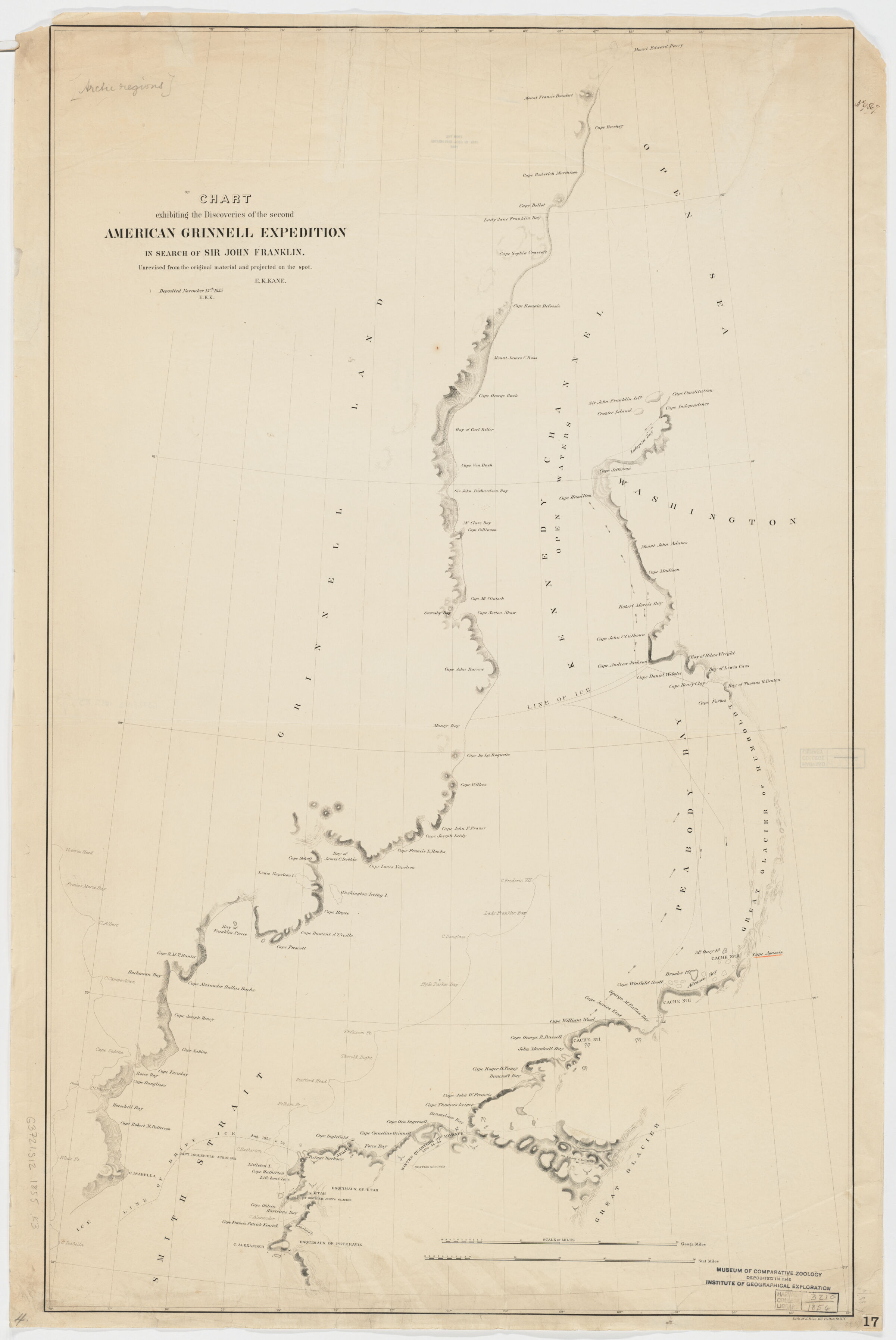
- Title
- Chart exhibiting the discoveries of the second American-Grinnell-Expedition in search of Sir John Franklin ; unrevised from the original material and projected on the spot
- Creator / Contributor
- Kane, Elisha Kent, 1820-1857, creator
Bien, Julius, 1826-1909 - Attribution
- E.K. Kane.
- Date
- [1855]
1853 - Place of Origin
- New York (State)
N[ew] Y[ork] - Publisher
- Lith of J. Bien
- Extent
- 1 map ; 89 x 56 cm.
- Language
- English
- Genre
- map
Maps - Digital Format
- Images
- Subjects
- Franklin, John--Maps
Arctic regions--Discovery and exploration--Maps
Northwest Passage--Discovery and exploration--Maps - Notes
- "Deposited Nov. 15th, 1855. - E.K.K."
Relief shown by hachures.
Covers Antarctic Peninsula.
Also available online.
Electronic reproduction. Cambridge, Mass. : Harvard Geospatial Library, 2011. Georeferenced image for use in a GIS. - Series
- Open Collections Program at Harvard University
- Repository
- Harvard Map Collection, Harvard University
- Record ID
- 990114319540203941
Tools & Related Links
- More item details
- HOLLIS Record
Contacts
-
Joseph deVeerLibrary Project Manager and Museum LiaisonErnst Mayr Library617-495-3946
-